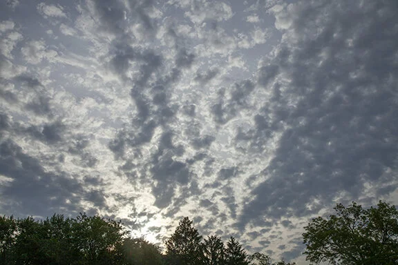
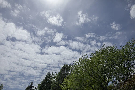
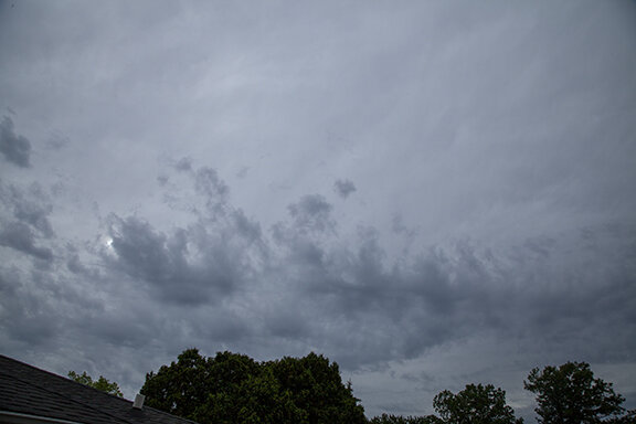
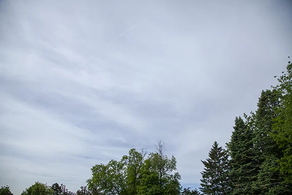
Clouds in the Middle Cloud family: altocumulus, altostratus, and nimbostratus and cumulonimbus (thunderstorm).
(Cumulonimbus is in the middle family IF its base is above 6,500 feet.)
Altocumulus
Puffy/heaped Clouds
between 6,500 and 20,000 feet
2,000 to 6,000 meters
Altocumulus: A middle level cloud found in patches or spread over the entire sky. Altocumulus are puffy or heaped clouds with individual cells that are isolated, found in groups, or in patterns of waves.
Rain or snow seldom fall from altocumulus but on rare occasions fall streaks of rain or snow might be seen below taller altocumulus. Altocumulus increasing and overspreading the sky may mean a large storm system is approaching.
Puffy clouds - Altocumulus
Wavy clouds - Altocumulus
Merged Puffy clouds with ripples- altocumulus
Puffy - altocumulus
A mix of Puffy and flat clouds - Altocumulus and altostratus
more Pillows - altocumulus
Pillows - altocumulus
Pillows - altocumulus
Puffy in waves - altocumulus withice crystal streamers
Castles (turrets) - Altocumulus. The turrets make the offcial name altocumulus castellanus (mid-level clouds that look like castle turrets.
Puffs and waves - Altocumulus
Puffy - Altocumulus floccus
Puffy in a group - Altocumulus pillows
Grouping of puffy pillow clouds - Altocumulus
Altocumulus above small cumulus below
Waves of puffy clouds - Altocumulus
Cirrus above a patch of altocumulus below
Altocumulus below a layer of cirrus above
Waves - Altocumulus
Pillows - Altocumulus
Pillows and waves - Altocumulus
Puffy - Altocumulus floccus (flocks of wool)
Altocumulus in ripples above cumulus below
Pillow clouds - Altocumulus
Puffy - Altocumulus
small puffy - altocumulus
Altostratus
Layered or Flat Clouds
between 6,500 to 20,000 feet
(2,000 to 6,000 meters)
Altostratus means ‘high’ stratus. Altostratus are found above low level stratus and below cirrostratus.
Altostratus: A gray sheet or layered cloud in patches or overspreading the sky. Altostratus may have waves, or rounded puff balls, or ripples but they are small compared to the overall cloud size. Usually altostratus are flat, gray, and not very interesting to look at but if the sky is filling with altostratus there may be a large storm system coming.
Flat clouds with waves - altostratus
two layers of cloud - altostratus above a lower layer of altocumulus and altostratus.
Flat layer - Altostratus
Mostly flat layer - Altostratus (few puffy elements mixed in altostratus)
Bands of flat clouds - Altostratus
Altostratus with Sun visible above the lower ragged cumulus clouds
Altostratus across top half of photo with lower cumulus underneath
Layer of altostratus
Flat layer with waves - Altostratus (colors are luminance - caused by light passing through water droplets)
Flat dull gray cloud layer - Altostratus
Flat cloud layer - Altostratus but with stratocumulus at bottom of photo
Layer of Altostratus
Nimbostratus
between 6,500 to 20,000 feet
(2,000 to 6,000 meters)
Nimbostratus is a thick gray uniform cloud with rain or snow. Nimbostratus do not include lightning or thunder. If there is lighting and thunder it is a cumulonimbus cloud. The nimbostratus base is usually diffuse - obscured by falling rain or snow. The photos below show the nimbostratus base better than was observed with the naked eye.


