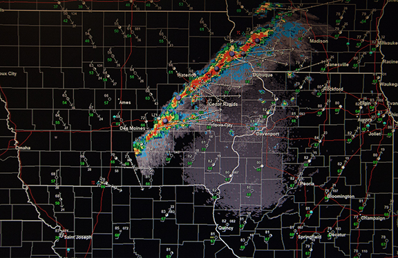
Cold Front on Radar
/Radar image from the National Weather Service Office in Davenport, Iowa. It was produced by StormLab software using National Weather Service radar data available on the internet at no charge. The software is available at http://www.interwarn.com/
Last evening a cold front moved across Iowa preceded by a narrow band of thunderstorms. Nearly a quarter-inch of rain fell in about 15 minutes. That is a rainfall rate of 1 inch/hour. How about temperatures? The high temperature ahead of the front was 85 degrees. Behind the front the low this morning was 37. The warm moist air ahead of the front was lifted by the cold front along a narrow band of instability.


