WEATHER FROM THE TOP DOWN
/As we move deeper into autumn the weather is becoming more energetic. The doldrums of summer are being replaced by stronger winds of the coming cold season. The reason is the increasing contrast in temperatures between the polar north and the warmer air to the south. The first graphic below shows the upper level winds at 35,000 feet this morning. Based on balloon soundings winds greater than 100 mph are found in the red shaded areas. The magenta area nosing into Montana includes winds greater than 150 mph at 35,000 feet. The green includes wind greater than 50 mph.
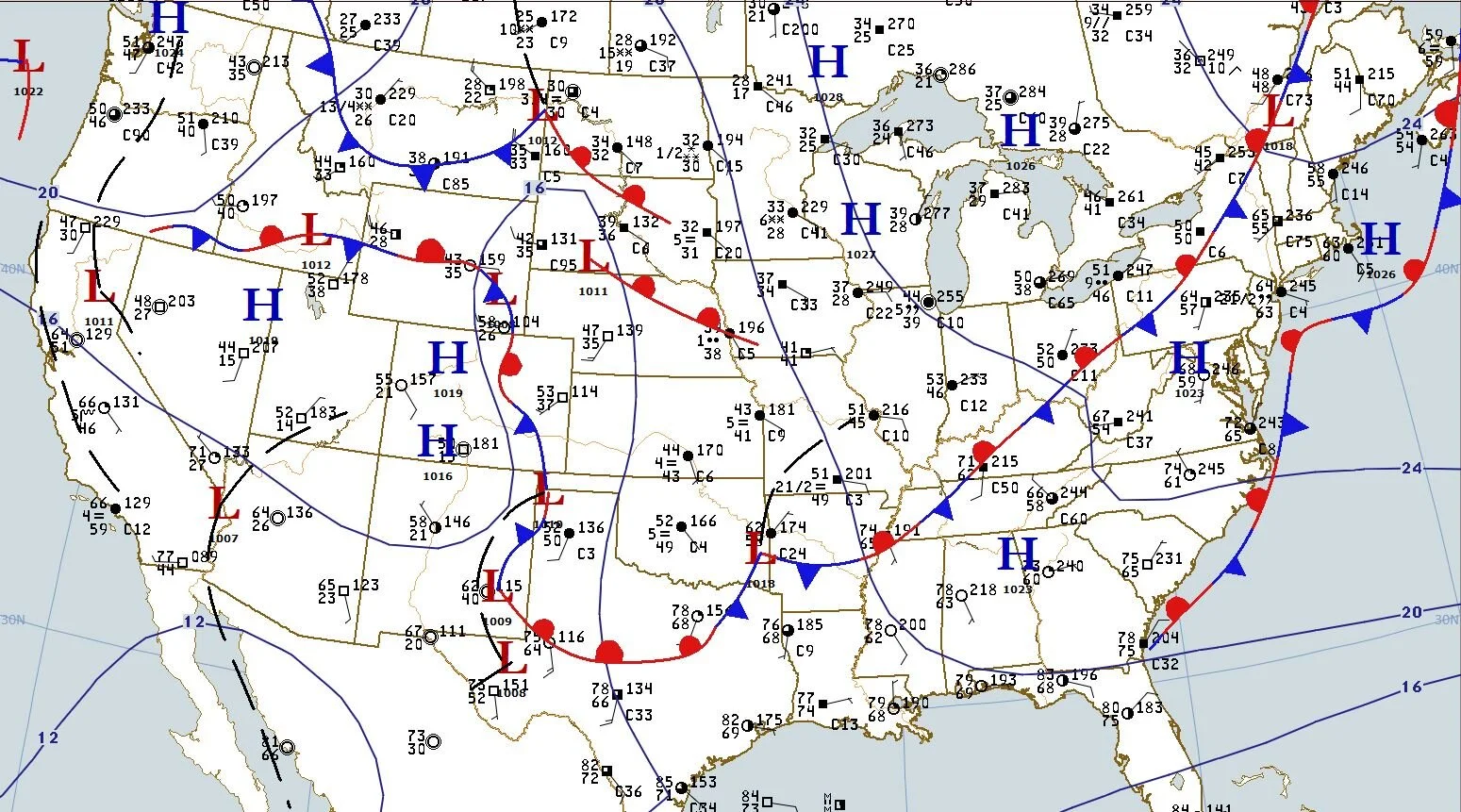
The surface map shows overcast skies in the colder air from the central U.S. to New England, the Great lakes and on to the northern Rockies into Canada. Notice the surface winds in Iowa - from the east and southeast.
The sounding below from the weather balloon launch at Davenport, Iowa this morning shows the vertical wind speed and direction profiles. On the far right of the chart notice the easterly flow (winds from the east) below 5 thousand feet. The flow is indicated with the wind speed and direction symbols. At 5,000 feet the direction abruptly switches to westerly and increases to greater than 50 mph. The change in direction and speed is called wind shear. I have posted examples of wind shear in the Clouds in Motion section of this website. The shear can be seen in the movement of the clouds.


