Looking High and Low - Tuesday, June 16, 2020
/Looking High…
The chart below shows the location of high and low pressure at about 18,000 feet this morning at 7:00 a.m. CDT. The red dashed lines are the temperatures at that level in degrees Fahrenheit. Notice the warmer temperatures are located within high pressure centers and the colder temperatures are associated with low centers.
This chart shows the upper flow crossing the West Coast and meandering into Canada then flowing to eastern Canada. over This pattern with a meandering flow and closed high and low pressure circulations does not change position quickly. That means the weather you had yesterday is the weather you have today and the weather you have tomorrow.
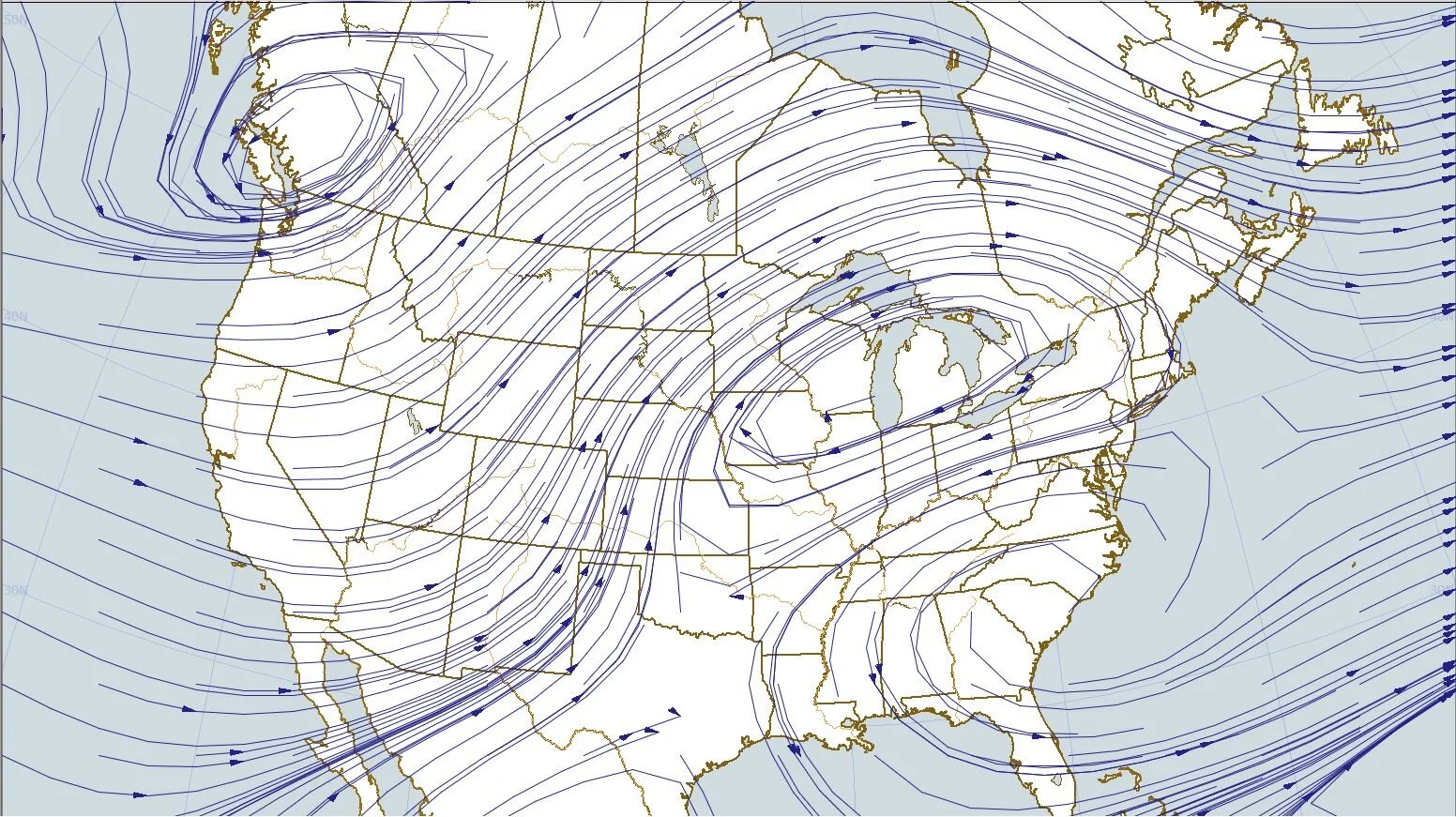
The next chart shows the streamlines at about 18,000 feet. It is a snap shot of the wind direction at 7:00 a.m. CDT. Winds are blowing clockwise around high pressure and counterclockwise around low pressure and illustrates the closed circulations that move very little from day to day.
Looking Low…
The next chart shows the surface weather map with the temperatures in degrees Fahrenheit shown by red dashed lines. Notice the warmest air at the surface is over the Plains and the coldest air is along the east coast and in the Pacific Northwest. The warmest temperatures are over the Plains in a southerly flow while the coolest air is under the cool low pressure aloft.
Because the upper flow is not changing position the weather at the surface is not changing much either.
The final chart shows the streamlines at the surface at 4:00 p.m. CDT this afternoon. Surface winds are from the south over the Plains bringing warm air northward. Cooler air is coming off the Atlantic Ocean into the eastern U.S. and also spreading inland from the Pacific Ocean into the western U.S.
The four maps above were plotted using Digital Atmosphere available at www.weathergraphics.com.
The map below shows weather advisories in effect this evening. To see the latest advisories go to www.weather.gov.
The pattern shown on the maps has most of the “action” in the western U.S. with fire weather Red Flag Warnings out in parts of California, Utah, Arizona, New Mexico, and Colorado due to dry conditions, low humidity, and strong winds that would dry vegetation and fan flames. Wind advisories out up in the Dakotas and western Minnesota, Nevada, and California, frost advisories in Oregon and Nevada, winter storm conditions in Montana and Idaho, and air quality alerts in Colorado, Wisconsin, and Illinois. These advisories are issued because of long term effects of dry weather and the short-term conditions causing strong winds and a variety of different weather. For every action there is an equal and opposite reaction. In this case weather is balanced out by warmer air moving north and colder air moving south.


