Awesome View!
/Awesome is certainly an overused word but it is one way to describe what we see when looking at Earth from space. One of my favorite university meteorology classes was satellite imagery interpretation. I especially enjoy looking at visible satellite imagery. Visible imagery uses visible light reflected from the Earth’s surface to make the images. The images are essentially what we would see from space.
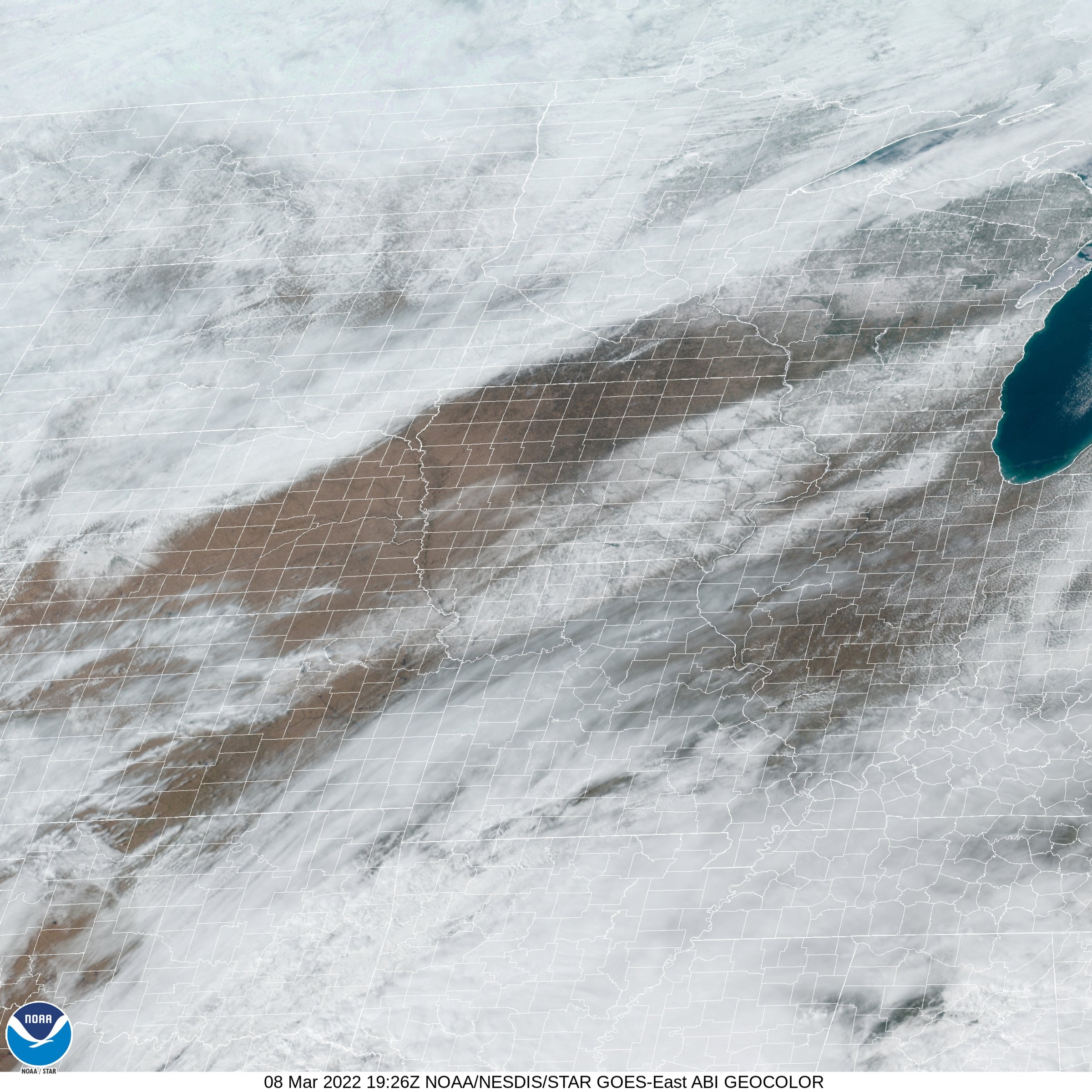
The image below was taken this afternoon by the GOES East Satellite. The time was 1:26 p.m. CST. Clouds cover most of the northwest half of the image - as far southeast as northwest Iowa. To the southeast in a strip from southeastern Nebraska across the southeast half of Iowa to Wisconsin is snow cover from the storm late Sunday into early Monday morning. More clouds are visible from Kansas into all but far northern Missouri before being scattered across Illinois. Breaks in the clouds reveal snow on the ground in Minnesota, the Dakotas, Wisconsin, and Upper Michigan. Notice the river valleys oriented from northwest to southeast in Iowa. The rivers are visible because of the trees and other vegetation that line their banks. The remainder of Iowa is mainly free of snow.
Cedar Falls, Iowa is located in northwestern Black Hawk County near the northwest edge of the snow cover. We received 3.8 inches of snow while other nearby areas reported 4 inches. It is interesting to note how 4 inches of snow looks from space.
Here is a little fun idea: Use the Iowa Rivers Map found here: https://www.mapsofworld.com/usa/states/iowa/iowa-river-map.html to name the rivers you see on the satellite image.


