Clouds of the Day
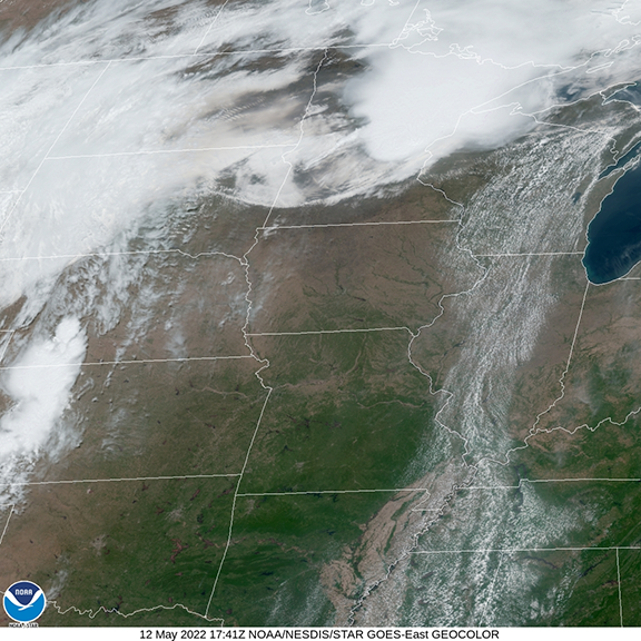
/Thunderstorms in east central Minnesota are pushing an outflow boundary of cooler air with its leading edge in southern Minnesota. Clouds on the leading edge clearly mark an arc bowing south as it moves toward Iowa. Behind the boundary are a mixture of clouds with the cumulonimbus anvil top of the thunderstorms visible north of the Twin Cities with cirrus blowing off the top into northern Minnesota. Hot air with temperatures in the upper 80s and 90s from Iowa south and southwest to the plains and lower Mississippi River Valley. A band of cumulus clouds is visible from Mississippi and Alabama northward to Upper Michigan.
It takes more than warm moist air to create thunderstorms. The highest temperatures with plenty of moisture are found in the region of clear skies from Iowa southward but there are no storms there. It is the difference in temperature horizontally and vertically that lead to rising motion and thunderstorms.


