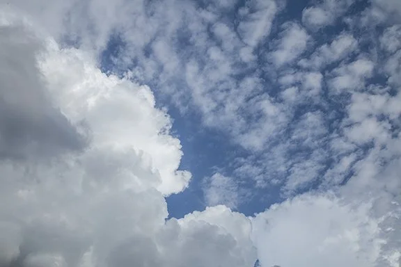
Clouds of the Day - June 27, 2022 - Two Cloud Layers
/Photo by Craig Johnson, Weather Briefing, L.C.
Billowing cumulus and a layer of altocumulus share the sky in this photo. The cumulus have their base below 6,500 ft but are building up toward the higher mid-level altocumulus clouds. The cumulus are forming because rising air in the low level of the atmosphere has reached its the level of free convection where the air is free to rise unhindered. As long as the temperature of the rising air is warmer than the surrounding clear air it will continue to rise, even through the altocumulus layer.
The altocumulus have formed in a layer of moist air where gentle rising motion is occuring. The layer is cooling as it rises which has caused clouds to condense. The depth of the layer is shallow so the vertical development of the puffy clouds is shallow - not as tall as the larger lower cumulus.
When water vapor condenses from an invisible gas to visible water droplets or ice crystals, heat is released. The result - as clouds form heat is released into the atmosphere. The heat was originally stored as latent heat in the water vapor. The heat used to evaporate the water becomes the latent heat. It is called latent because as the water vapor moves with the wind the heat goes with it. That heat is not sensed, but it it there and released in a different place when condensation occurs. This process is an important part of the water cycle and it allows vast amount of heat to be moved around the world on the wind without causing a rise in temperature. The temperature only rises when the heat is released by condensation into a cloud and precipitation. This thermostat is an indispensable part of the Earth’s heat budget.


