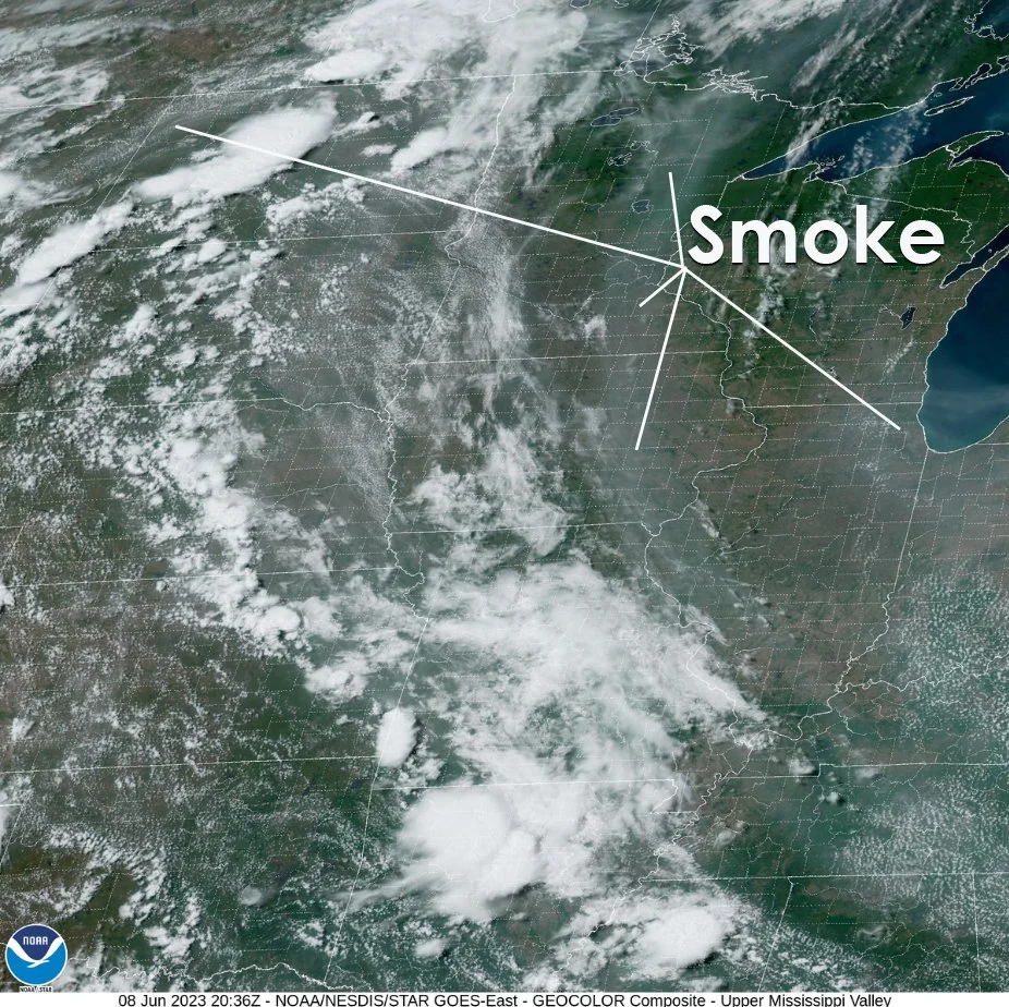
Clouds of the Day - Thursday, June 8, 2023 - More Smoke
/The GOES 16 visible satellite image from this afternoon at 20:36Z is showing more smoke over the Upper Midwest. There are several bands of smoke visible. The smoke is not as dense or reducing visibility like has been experienced in the northeastern U.S. The smoke here is aloft - not near the ground. It has been creating a smooth milky sky. This image is courtesy of NOAA/NESDIS STAR GOES EAST. The text is added by Weather Briefing, LC.
You will also notice thunderstorms over North Dakota, South Dakota and south into Nebraska. The storms in North Dakota are sporting large anvils while the storms in South Dakota and Nebraska have much smaller anvils. Anvils are also visible in northeastern Kansas to Arkansas. Look closely and you can see the shadows cast on the ground by the anvils. Cumulus cloud fields are over the Plains and also in southern Indiana through Kentucky to Tennessee. The Cumulus fields indicate low level instability caused by solar heating. The thunderstorms indicate areas of much deeper instability caused by other factors that are aided by solar heating.