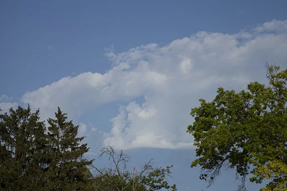
Clouds of the Day - Thursday, August 24, 2023 - High Cumulus
/This post is under construction.
High Cumulus are cumulus that form in the middle layers of the Troposphere. You might wonder how cumulus in the middle layer of the atmosphere can be called high cumulus. It’s because middle level cumulus are higher than cumulus in the lower layer. Low level cumulus are just called cumulus.
Altocumulus floccus (tufts of wool)
The Troposphere is the layer of air in the lowest 6 to 10 miles of the Earth’s atmosphere. There are three general cloud families in the Troposphere; low, middle and high.
Next, there are three basic cloud types - stratus, cumulus and cirrus. Stratus are layered clouds, cumulus are puffy or heaped clouds, and cirrus are high hair-like or wispy clouds. Stratus and cumulus clouds are found in all three layers but their names are changed depending on the layer. Cirrus are located the highest layer where temperatures are colder. Cirrus contain mainly ice crystals.
Altocumulus floccus (tufts of wool)
Cumulus in the lowers layer below 6,500 feet (2000 meters) are called, Cumulus. Cumulus in the next highest layer (the middle layer) are called Altocumulus (high cumulus). In Latin Alto means high so middle level cumulus are called Altocumulus - high cumulus.
The highest cumulus clouds are found above the middle layer. They are given the prefix ‘cirrus’ as are all clouds in that layer. Therefore cumulus in the highest layer are called cirrocumulus.
Altocumulus castellanus (castle turrets)
Altocumulus Cumulonimbus congenitus (a failed attempt to form a cumulonimbus)
This post is featuring middle level clouds. All the clouds in the sky today were middle clouds. The most unusual was the cumulonimbus congenitus. It has the look of a miniature cumulonimbus - or thunderstorm but that is all it has. It is not capable of of producing precipitation or lightning and thunder. It just has that look. What it does demonstrate is that weather systems of many sizes share similar characteristics. From the biggest systems to the smallest the circulations that cause them are similar, if not exactly the same except for the size. A cumulonimbus congenitus is just too small to be a real thunderstorm. They are very high based and only light precipitation might reach the ground. On this day, nothing reached the ground. It is an Altocumulus type cloud because it is in the middle levels.


