Clouds of the Day - Sunday, December 6, 2020
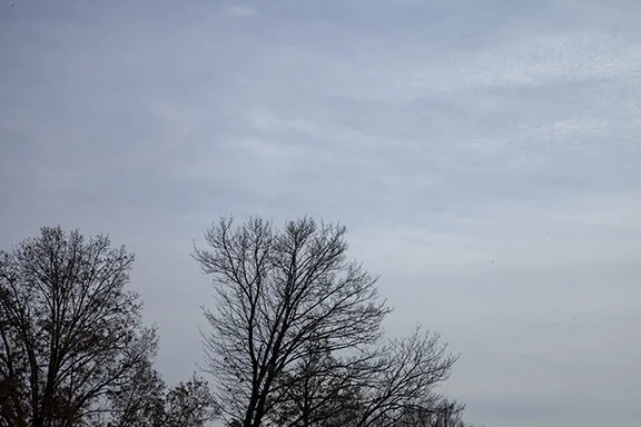
/Cirrus fibratus
Cirrus fibratus
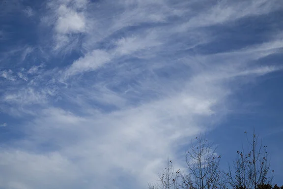
Cirrus fibratus and altostratus undulatus
Cirrus fibratus
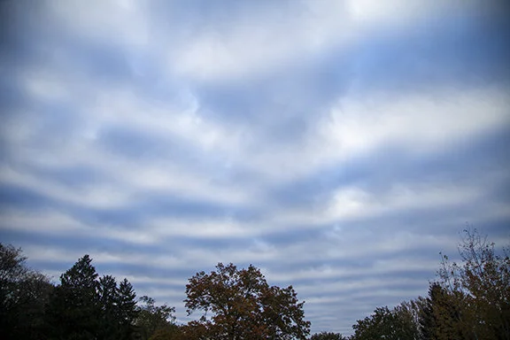
Cirrostratus and Cirrus fibratus
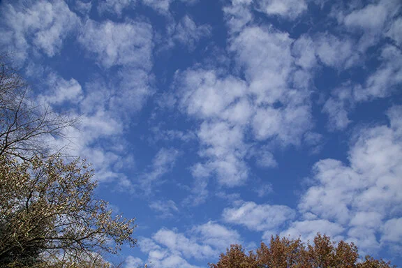
Cirrus fibratus and cirrostratus, Altocumulus lower left
To purchase our 24” x 36” full color cloud chart, go to our online store. It is suitable for framing in a standard 24” x 36” frame.

Learn how to identify clouds by following the Clouds of the Day posts below.

Cirrus fibratus

Cirrus fibratus

Cirrus fibratus and altostratus undulatus

Cirrus fibratus

Cirrostratus and Cirrus fibratus

Cirrus fibratus and cirrostratus, Altocumulus lower left

Cirrus fibratus

Close-up of Cirrus fibratus

Close-up of Cirrus fibratus

Cirrus uncinus

Altocumulus

Cirrus uncinus directly overhead

Cirrus uncinus

Altocumulus with holes

More Altocumulus with holes

Altocumulus floccus

Altostratus undulatus (with waves)

Cirrus fibratus and altocumulus
Cirrus clouds are found in the highest parts of the troposphere, above 16, 500 feet. They are not the highest clouds in our atmosphere but they are the highest that we see every day. Cirrus is one of the ten primary cloud types but it is also the name used to describe this family of clouds. The other cirrus types in this family include cirrostratus and cirrocumulus. When species and variety names are used to classify the cirrus types the list of names becomes quite long. Check out the online Cloud Atlas for more information.
This day featured only cirrus clouds. The low and middle layers of the atmosphere were quite dry. A weak wave (upper level system) crossed Iowa but with moisture lacking only these high clouds were observed. It is common for weak systems to move along the westerlies regularly but without moisture we hardly notice them. These systems will often change our wind direction and barometric pressure and sometimes make slight changes in temperature. Other than that, most people go about their daily activities without knowing these systems pass by.

Cirrostratus

Cirrostratus

Cirrus fibratus and Cirrostratus

Cirrostratus

Cirrostratus

Cirrostratus, Cirrus, and Cirrocumulus

Altocumulus in background and cumulus in foreground after sunrise

Cumulus in foreground and Altocumulus in background after sunrise

Cumulus in foreground and Altocumulus behind

Altocumulus, cumulus and stratocumulus after sunrise
Sunrise view of Altocumulus and cumulus


Cirrostratus at Sunrise

Cirrostratus at Sunrise

Cirrostratus with halo

Cirrostratus

Altocumulus undulatus

Cirrus at Sunrise

Cirrus at Sunset

Cirrostratus at Sunset

Altocumulus congenitus (behind trees) and Cirrostratus (top)

Cirrostratus at Sunset with Contrails
Altocumulus are middle level clouds with an altitude between 6,500 feet and 20,000 feet. This common form of altocumulus is shown below with pillow-like cloud cells formed in a broad sheet. Since it is a broad layer of cloud with small cells vertical development it is a stratiform version of altocumulus. The cloud elements are arranged in disorganized lines, indicating undulations (waves) are in the flow moving through the layer. The clouds are enhanced at the crest of a wave. The lighter areas around the cells are caused by sinking air motion around the edges of the cells and at the troughs of the waves. Only time lapse photography would show the waves.
Alto means “high” so altocumulus means high cumulus. Cumulus are found in the lower layer of atmosphere, below 6,500 feet, so high cumulus indicates the clouds are in the middle level. The middle level is between the low layer and the high cloud (cirrus) layer. Altocumulus stratiformis indicates the cloud is a layer cloud. Altocumulus indicates there are cumulus formations present within the layer.

Altocumulus stratiformis undulatus

Altocumulus stratiformis

Altocumulus stratiformis with organized undulations visible bottom center to bottom right. The undulations appear as darker bands across the lower part of the photo and give stratiformis the second name (species) in the cloud name.

Altocumulus stratiformis undulatus.

Stratocumulus. This low type cloud is a layer of cumulus clouds with the stratus (layer) characterisitics. Therefore the name is stratocumulus.

This turbulent sky was filled with cumulus in unorganized ragged patterns. In this photo the cumulus were not part of a consistant layer. They were mostly individual cells.
It was the coldest morning so far this season with the temperature bottoming out at 16 degrees F. My CoCoRaHS rain gauge was coated with frost and the .30 inches of rain that fell the previous 24 hours is visible frozen solid in the inner cylinder. This is a concerning situation for a plastic rain gauge but this gauge is tough; it came through with flying colors. But I usually don’t tempt fate with this gauge when temperatures fall below freezing and neither should you. I brought it into the house and let is thaw slowly on the kitchen counter.
You can read about the CoCoRaHS program at the bottom of the home page. If you are inclined to be a volunteer observer for the network will need to purchase the rain gauge (they are not expensive). It is a worthy project for anyone interested in the weather and with the time to take a precipitation observation once a day. They do need reliable volunteers.

Stratocumulus clouds look like cumulus and stratus all rolled into one cloud. The two photos below show one example of stratocumulus. The cumulus are in a layer which gives them the stratus layered characteristic while also having the vertical development of cumulus clouds. As you will see by looking through this blog stratocumulus may have different looks but they all feature elements of stratus and cumulus. They must form a layer and they must have internal formations of cumulus, usually as individual cells or wavy rolls.
There is a small patch between the trees in the bottom photo that really looks like cumulus because of the individual cellular structure. It is a close-up of the photo above it. Since it is within a general layer formation I would just call the entire formation stratocumulus, but one could certainly argue that that small area is more of the cumulus formation. There is room for a difference of opinion.

Stratocumulus

Stratocumulus
Cirrostratus often form a veil covering large areas of the sky in one transparent sheet. The veil in the photo below has been punctuated by a jet contrail. The veil is thicker than exhibited by many cirrostratus. Cirrostratus may create halos around the Sun or Moon due to the alignment of ice crystals which bends (refracts) the light passing through the cloud. Examples of haloes are found elsewhere in this blog. Just keep scrolling down until you find them.

Cirrostratus with a single contrail
Sometimes the sky is just plain chaotic. The photos below show various forms of cirrus clouds. Some of the clouds are fibrous, while others are hair like, or in sheets or clumps. High winds aloft, above 20,000 feet, smear the clouds into many contorted shapes. Because these clouds are made mostly of ice crystals that fall from the cloud bases, the sky often looks like the clouds are brushed on over a blue canvas. The shapes often change every few minutes. Our “Clouds in Motion” section has good examples of cirrus and I will be adding more.

Cirrus are located upper left, cirrus floccus are found left center and upper left, and cirro stratus are in the lower right. Cirrus fibratus are bused in the center right and also in the left center.

Cirrus fibratus (top), cirrus spissatus (top, and cirrus (center and lower left).

This is a close-up of cirrus fibratus and cirrus floccus.

More cirrus fibratus and cirrus floccus

Cirrus spissatus (lower center and left center), Cirrus fibratus from the left center through the center to the upper right. Cirrus floccus is also scattered from the left center to the upper right.
How about this for a sky? No, this is not Colorado or another mountainous state where lenticularis clouds are common. The altocumulus lenticularis shown below are usually not found in the sky over Iowa but they do occasionally make a visit. Lenticularis clouds are lens shaped, which form as large waves ripple through the atmosphere. There is also an example of a Kelvin-Helmholtz waves. It was quite a day for sky watching.

Altocumulus lenticularis

Altocumulus stratiformis

Altocumulus lenticularis

Altocumulus lenticularis

Altocumulus lenticularis and altocumulus stratiformis

Kelvin-Helmholtz waves moving through altocumulus clouds.

Altocumulus stratiformis undulatus

Altocumulus floccus and altocumulus undulatus

Altocumulus stratiformis undulatus

Stratocumulus

Stratocumulus

Altocumulus

Altocumulus
This is a dramatic sky! The altocumulus were very large cloud elements, much larger than normal. Cirrus was also present with many fibrous streaks.

Altocumulus floccus

Altocumulus

Cirrus fibratus

Altocumulus floccus

Cirrus fibratus with fall streaks

Altocumulus

Altocumulus stratiformis lenticularis

Altocumulus stratiformis
Clouds often form in different layers. In the photo the lower layer is stratocumulus. The layer above, which is partially covering the Sun, is altostratus. The second photo shows three different cloud types on three different layers.

Stratocumulus with altostratus above

Altostratus in a broad layer with thin altocumulus undulatus below is dark streaks. Altocumulus are scattered across the top of the photo.
Clouds are not necessarily easy to identify. While we classify clouds into types based on their height of the ground and their shapes, textures, and precipitation, clouds do not always fit the mold. Clouds form on a continuum so sometimes they look like combinations of several clouds. All we can do is make our best estimate of the cloud type.
Below we have an altocumulus cloud because it is above 6,500 feet and below 16,500 feet. The cloud layer had cumulus elements, clouds with vertical development. They were mixed together in a layer, which is a stratus time cloud. The photo does not pick up the essence of the cloud except that it is possible to see some of the individual puffy elements found in cumulus.

Altocumulus

Altostratus layer with altostratus and altocumulus in the cloud patch below.
There is something about autumn colors mixed with blue sky and white puffy clouds. This is another example of the beauty that surrounds us in the Midwest of the USA. Of course, we don’t hold a patent on great days and beautiful colors. The Earth’s weather provides breath-taking beauty even though storms wreck havoc from time to time. It is all part of a system that provides the essentials of life. This day featured a calm backdrop color and beauty for all to enjoy. The clouds dissipated at sunset as the sun set and its heat moved to another part of the Earth. It returned the next day when the sun rose again.

The cirrus in the photos below are showing off the hair-like filaments that give cirrus their name. These transparent clouds consist of ice crystals. The crystals are being swept along by high altitude winds above 16,000 feet. Look closely at the top photo reveals bands of cirrus that are perpendicular to the vertical streaks that dominate the photo. The vertical streaks are falling ice crystals. The perpendicular bands are caused by waves in the flow. The waves are similar to the waves we see on the ocean or in lakes.


The photo above shows streaks of cirrus mixed with waves. Just to the right of center are very small waves with more to the lower right that are difficult to see. Waves in the upper left are more distinct.
Copyright 2016-2024, Weather Briefing, L.C.
Cedar Falls, IA 50613, Phone: 319-215-2634, Email: craig@weatherbriefing.com