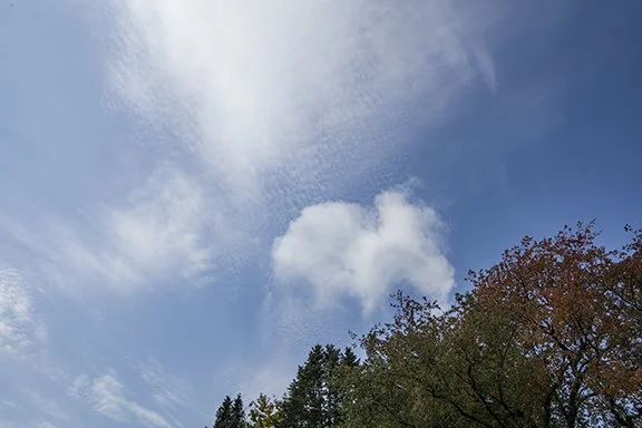
Clouds of the Day: Cloud Invasion
/Our day began with patchy mid-level clouds but as low level moisture increased a Stratocumulus deck formed as shown in the sequence of photos below. Showers and thunderstorms are expected along a cold front tonight and tomorrow. Strong winds and hail will be possible.
Altocumulus and Altostratus at 11:00 AM this morning. Match the time on the weather maps below.
Also at 11:00 AM high Altocumulus and Altostratus appear above the small cumulus cloud.
By mid-afternoon a stratocumulus cloud deck had overspread the area. Dew points quickly increased from the mid-40s into the 50s due to southerly surface winds from the Gulf of Mexico.
Another look at the Stratocumulus deck. The sky appeared to be clear above the clouds although there may have been mid-level clouds in patches similar to what we had in the morning.
The dotted green line is the dew point for the 48 hours ending 3:45 PM, Tuesday, Otober 11, 2022. As mentioned in the text above with the photos moisture was increasing during the day which formed Stratocumulus clouds by mid-afternoon. Low level upward motion caused the moisture to rise and the cooling caused condensation and cloud formation. The increasing dew point can be seen beginning after 4:00 AM on October 11th (today). You can see that the dew point stopped increasing shortly before Noon and as clouds covered the sky, the temperature (red line) cooled and the relative humidity increased. If the dew point stays the same and the temperature cools the relative humidity increases.


