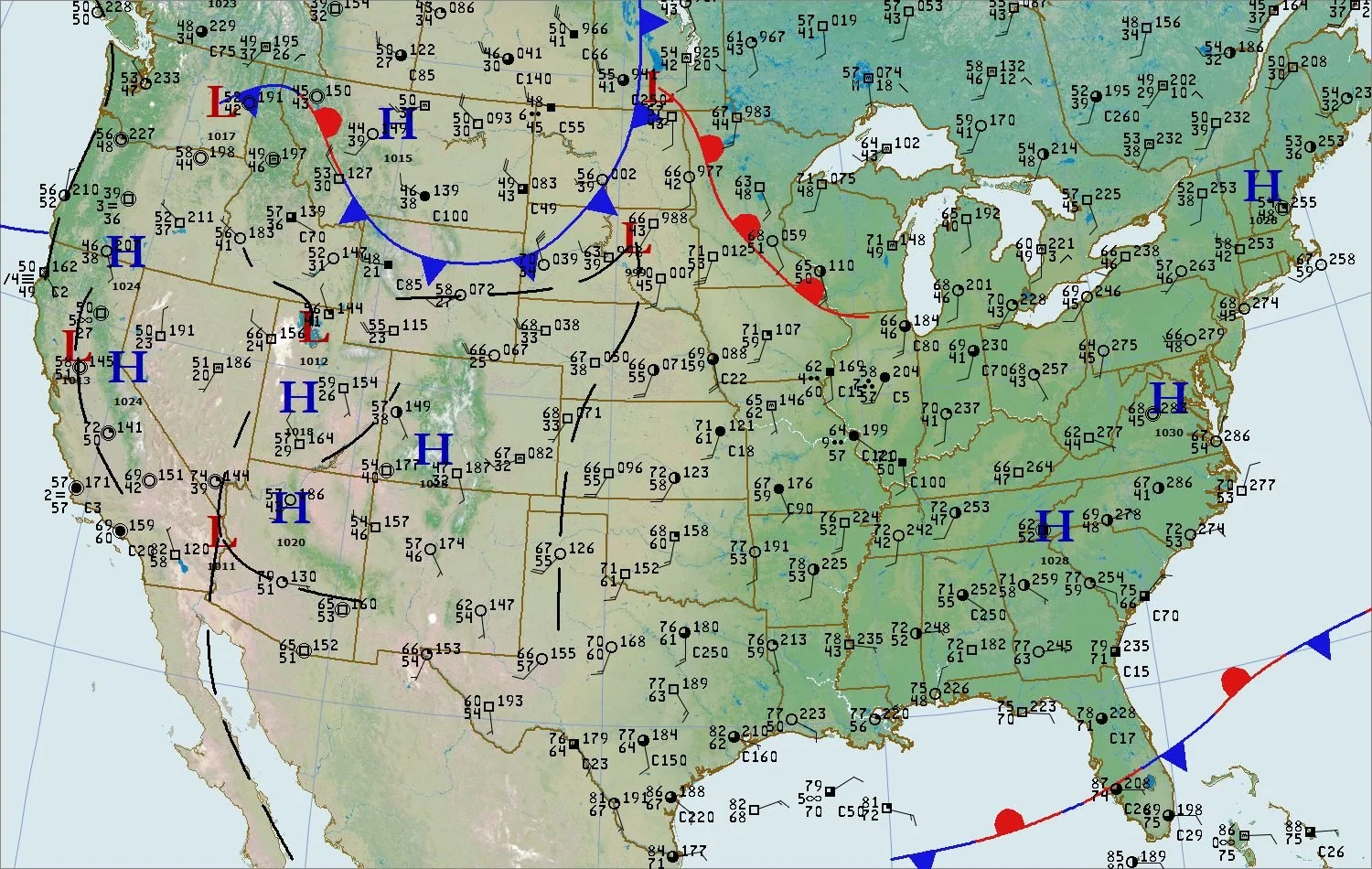
Colder air headed to the Northern Plains
/Refer to the Station Model Plot Tutorial to read the weather station observation plots. Temperatures in the 40s to lower 50s are being reported from a Canadian air mass entering the northern and central plains. The leading edge of the cold air extends across the Dakotas to Wyoming and western Montana. The weather is quiet ahead of this system with temperatures in the 60s and 70s. High pressure covers the eastern United States and much of the western United States. See the the Weather Briefing links on our home page for the latest discussions from the National Weather Service. Follow the front in future posts here.
USA Surface Map with Station Model Plots - 11:00 AM, tUESDAY, October 11, 2022, Plotted by Digital Atmosphere; Software available from www.weathergraphics.com.
wEATHER dEPICTION mAP - 11:00 AM, tUESDAY, oCTOBER 11, 2022, pLOTTED BY dIGITAL aTMOSPHERE sOFTWARE, WWW.WEATHERGRAPHICS.COM; tHIS MAP PLOTS: WEATHER, VISIBILITY, CLOUD COVER, CLOUD CEILING (BASE), WHETHER OBSERVATION IS AUGMENTED BY AN OBSERVER (CIRCLE) OR ENTIRELY AUTOMATED (SQUARE); WIND DIRECTION AND WIND SPEED.
sURFACE WIND DIRECTION mAP - tHIS MAP DRAWS STREAMLINES WHICH SHOW THE FLOW OF AIR AT THE SURFACE FOR 11:00 AM, tUESDAY, oCTOBER 11, 2022. nOTICE HOW THE AIR IS FLOWING CLOCKWISE OUT OF HIGH PRESSURE CENTERED OVER Virginia. tHE AIR IS CONVERGING AT THE COLD FRONT CROSSING THE UPPER MIDWEST AND THE gREAT pLAINS.


