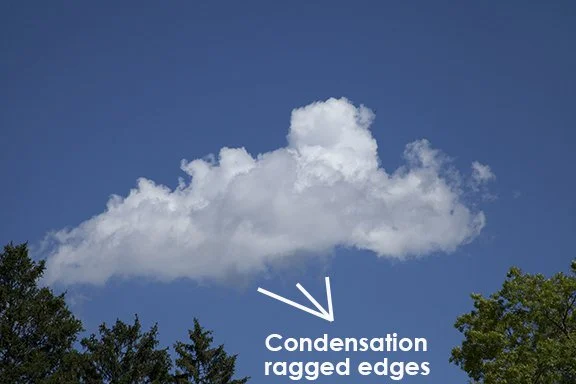
Clouds of the Day: Thursday, August 10, 2023
/The ragged edges along the bottom of this Cumulus cloud are forming in the updrafts of moist air rising into the cloud. The edge is ragged because the concentration of water vapor varies slightly below the cloud condensation level at the cloud base. It creates ribbons of cloud in the updraft.
This cloud is much higher than the cloud to the left. It is an Altostratus cloud because it is in a layer that is much wider than it is tall. There are elements of Cumulus-type clouds impressed within the layer where vertical motion is sufficient enough to create lumpy clouds in the layer but over-all this is an Altostratus cloud.
The clouds below are Altocumulus. The cloud elements are grouped in a large patch made up of individual Cumulus type clouds. Because they are above 6,500 ft and below 20,000 they are Altocumulus - which is high cumulus. They are much higher than the singular Cumulus cloud in the photo above.
Altocumulus with Cirrus above.
This small patch of Altocumulus is just beginning to form.


