High and Low Clouds: Saturday, August 8, 2023
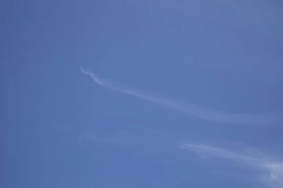
/Clouds up high and clouds down low, these clouds have different shapes and textures. The photos show water in 2 of 3 of its phases; vapor, liquid, and ice.
First, the air in all three photos contains water vapor, which is the invisible form of water. Water vapor occurs when ice sublimates, which is ice passing directly from the solid state to an invisible gas (water vapor) without first becoming a liquid, or by liquid water evaporating or boiling.
The top two photos are wispy, hairlike clouds (Cirrus and Cirrus uncinus) which are made primarily of ice crystals. While Cirrus are mostly ice crystal clouds, water can exist as a liquid in the atmosphere down to -40 degrees F. Clouds between 32 degrees and -40 degrees may have a mixture of water and ice, depending on other conditions at the cloud level. Cirrus have soft edges because the ice is sublimating, which takes more time than evaporation. Sublimation leaves a softer edge to the cloud.
The third photo shows a disintegrating Cumulus cloud which is liquid water (cloud droplets) evaporating. This cloud is warmer than the freezing point of water so it is made of liquid water droplets.
Low clouds in the atmosphere (surface to 6,500 ft) may be all water droplets or a mixture of water and ice. Only in very low temperatures with readings down to -40 degrees F, or colder, would clouds usually be entirely ice.
Mid-level clouds, 6,500 ft. to 20,000 ft. above mean sea level, will be entirely water vapor at temperatures above freezing, or they are a mixture of water and ice at temperatures below freezing.
Most Cirrus-type clouds are entirely ice but Cirrocumulus usually have a mixture of water and ice.


