Clouds of the Day - May 2, 2020

Where will Clouds Form?

Don’t let the chart panic you. The cloud photos are below.

Below is a RAOB sounding. Soundings are taken from select locations globally twice daily; at 00Z and 12Z. The Z stands for Zulu which is the same as UTC/Universal Time).

The sounding above was taken at Omaha, Nebraska this morning at 7:00 a.m. CDT. (12Z is 7:00 a.m. CDT). Learn more about telling time near the bottom of our home page.

To make a long story short weather balloon soundings are taken globally at the same time. In the contiguous United States that means when soundings are taken at 12Z it is 8:00 a.m. in the Eastern Time zone, 7:00 a.m. in the Central Time Zone, 6:00 a.m. in the Mountain Time Zone, and 5:00 a.m. in the Pacific Time Zone.

RAOB Sounding above was plotted using the RAOB software Program available here: https://raob.com/

RAOB Sounding above was plotted using the RAOB software Program available here: https://raob.com/

Now to the sounding. The red line is temperature - cooler is to the left and warmer is to the right. The green line is dew point (moisture). The dew point decreases to the left and increases to the right. Look at the altitude scale on the right side of the chart. It is labeled from 5,000 (5) to 50,000 (50) feet. There is also a scale for KM (kilometers). I am not going to discuss the scale on the left side of the chart but it is in millibars of air pressure. The wind barbs going up the right side indicate wind direction and speed. If you look at the Decoding Weather Maps section on this website you will be able to read the wind direction and speed changes with altitude.

For this blog let’s look at moisture vs. temperature. Where the green and red lines are closest together the relative humidity is greatest. Where the lines are farther apart the air is drier. The gray block on the left side of the chart shows where this sounding indicates clouds are most likely occurring. It is just an indication. It is dry in the lower levels below 10,000 feet and above 35,000 feet with clouds likely in between. It means an observer at Omaha at 7:00 a.m. CDT may see clouds in that layer at that time.

I live in Cedar Falls, Iowa which is in northeast Iowa. Notice the wind direction and speed in the moist layer between 10,000 and 35,000 feet above Omaha. Winds are from a westerly direction (from the west) between 20 and 50 knots (23 to 58 mph) at Omaha. Upper air maps showing other weather balloon soundings show the air flowing from Omaha toward east and northeast Iowa.

Cedar Falls is not straight east from Omaha but we might expect that layer of moisture to spread east and pass over Cedar Falls. It’s already here. Below I have posted cloud photos taken at around 9:00 a.m. CDT at Cedar Falls. The clouds are in the zone where we might expect to see them based on the sounding from Omaha.

RAOBS are only a snapshot at a moment in time from a balloon sounding taken as the balloon rises and moves with the wind. It is not a prediction of what will happen a few hours from now or at a location downstream. It is merely an indication of what is occurring now. Soundings are critical in our arsenal of weather forecasting tools. To see the latest soundings from the Storm Prediction Center website click here.

Weather balloon launch photo courtesy of the National Weather Service.

Weather balloon launch photo courtesy of the National Weather Service.

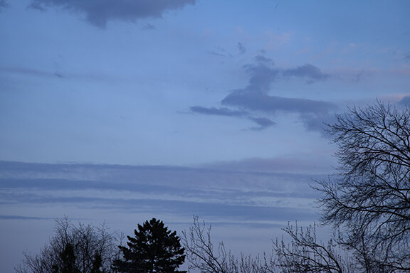
Cirrus - Looking west from Cedar Falls.

Cirrus - Looking west from Cedar Falls.

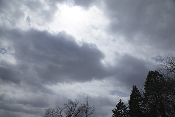
Cirrostratus (upper right), Altocumulus (upper left & upper center), Altostratus (lower center & Lower left). Looking South from Cedar Falls.

Cirrostratus (upper right), Altocumulus (upper left & upper center), Altostratus (lower center & Lower left). Looking South from Cedar Falls.

As clouds lowered and thickened the solar radiation trace showed large short term changes in radiation reaching the surface. Cloud cover was controlling what was reaching the ground. Compare the peak power from today with the peak power from yesterday.

Solar_Radiation_5-2-20.PNG

Then the cloud type changed and the ceiling lowered from high to mid-level clouds…

Altostratus with cumulus below. Looking east. Photo taken after very light rain. Trace of rain fell.

Altostratus with cumulus below. Looking east. Photo taken after very light rain. Trace of rain fell.

Alostratus with cumulus below. Photo looking South-southeast.

Alostratus with cumulus below. Photo looking South-southeast.

Looking south-southwest at altostratus and altocumulus. THere is light rain falling from darkest clouds near the bottom-right of the photo. Rain is very light with radar indicated onlytrace amounts expected. Our relative humidity is 45% so lower lev…

Looking south-southwest at altostratus and altocumulus. THere is light rain falling from darkest clouds near the bottom-right of the photo. Rain is very light with radar indicated onlytrace amounts expected. Our relative humidity is 45% so lower levels of air mass is drier than mid-levels.

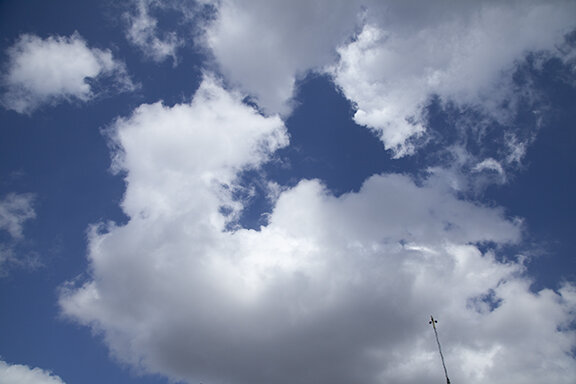
Altocumulus.

Altocumulus.

Altocumulus

Altocumulus

Clouds of the Day - April 30, 2020

Contrail - After a day with no clouds in the sky a lone contrail (condensation trail) moved overhead during the evening. Condensation trails form when water vapor in jet engine exhaust condenses as ice crystals. Sometimes contrails may overspread mo…

Contrail - After a day with no clouds in the sky a lone contrail (condensation trail) moved overhead during the evening. Condensation trails form when water vapor in jet engine exhaust condenses as ice crystals. Sometimes contrails may overspread most of the sky. In this case the contrail remained as a single line. It moved from the western sky to the east with little change in its shape.

Clouds of the Day - April 29, 2020

Stratocumulus often form in a cool moist air mass. Low level air is moist while the air above is dry. Blue sky is usually seen above the stratocumulus. Temperatures were in the upper 50s this afternoon with wind gusts near 50 mph.

Stratocumulus often form in a cool moist air mass. Low level air is moist while the air above is dry. Blue sky is usually seen above the stratocumulus. Temperatures were in the upper 50s this afternoon with wind gusts near 50 mph.

This photo shows a nearly continuous layer of stratocumulus. Except for the lumpy bases, which is a feature of cumulus, these clouds have the look of stratus. The combination is called stratocumulus.

This photo shows a nearly continuous layer of stratocumulus. Except for the lumpy bases, which is a feature of cumulus, these clouds have the look of stratus. The combination is called stratocumulus.

Here is another example. these clouds look much like stratus but observing more closely we see rounded cloud bases in the lower right and upper left.

Here is another example. these clouds look much like stratus but observing more closely we see rounded cloud bases in the lower right and upper left.

This is a good example of stratocumulus. The clouds have some vertical development but their bases are much broader than the vertical cloud height.

This is a good example of stratocumulus. The clouds have some vertical development but their bases are much broader than the vertical cloud height.

Here are a More classic stratocumulus cloud. These clouds show a definite layered look but with the vertical look of small cumulus. The result again is stratocumulus.

Here are a More classic stratocumulus cloud. These clouds show a definite layered look but with the vertical look of small cumulus. The result again is stratocumulus.

Another nearly solid layer that looks more like stratus except for the lumpy bases. Once again we have stratocumulus.

Another nearly solid layer that looks more like stratus except for the lumpy bases. Once again we have stratocumulus.

Finally, in this photo the couds show their cumulus side very well. There are definite puffy cells but they are mixed into a layer with little vertical height compared to its vertical extent. That makes them stratocumulus.

Finally, in this photo the couds show their cumulus side very well. There are definite puffy cells but they are mixed into a layer with little vertical height compared to its vertical extent. That makes them stratocumulus.

Cumulus clouds - By evening this is all that remained. Temperatures were cooling so updrafts were weakening with only small cumulus left over.

Cumulus clouds - By evening this is all that remained. Temperatures were cooling so updrafts were weakening with only small cumulus left over.

A few minutes later the cumulus clouds were even smaller. The sky cleared just after sunset.

A few minutes later the cumulus clouds were even smaller. The sky cleared just after sunset.

Clouds of the Day - April 27, 2020

Altocumulus at sunrise. These waves occur in a stable air mass so they look like waves on water. The waves do not get taller because the layer where they form does not allow deeper rising currents to form. The formation is different than what is hap…

Altocumulus at sunrise. These waves occur in a stable air mass so they look like waves on water. The waves do not get taller because the layer where they form does not allow deeper rising currents to form. The formation is different than what is happening in the photo below.

These altocumulus are wave type clouds. The undulations create clouds at the top of the waves and clear areas in the trough of the waves. Moisture must be sufficient to make the waves visible through condensation.

These altocumulus are wave type clouds. The undulations create clouds at the top of the waves and clear areas in the trough of the waves. Moisture must be sufficient to make the waves visible through condensation.

Looking west at the same time as the first two photos we see a different type of altocumulus. These clouds are in a layer of more unstable air than the clouds above. They are cells circled by small areas of blue sky. The cells occur because of risin…

Looking west at the same time as the first two photos we see a different type of altocumulus. These clouds are in a layer of more unstable air than the clouds above. They are cells circled by small areas of blue sky. The cells occur because of rising motion while the blue sky around them is due to sinking motion. Their shape looks more like the familiar “cotton-ball” type cumulus we see on warm humid days.

Altocumulus

Altocumulus

Altocumulus

Altocumulus

Altocumulus

Altocumulus

Altocumulus

Altocumulus

Clouds of the Day - April 26, 2020

Satellite image from NOAA/NESDIS/STAR GOES-16 (East). Photos of today’s clouds will follow. For now, a field of cumulus clouds formed over the middle of Iowa into Minnesota. There is a chance for a few showers or thunderstorms to form within this area along with a small risk of “cold air” funnel clouds.

Satellite image courtesy of NOAA/NESDIS/STAR; https://www.star.nesdis.noaa.gov/star/index.php

Satellite image courtesy of NOAA/NESDIS/STAR; https://www.star.nesdis.noaa.gov/star/index.php

Today’s solar radiation (graph on far right) shows a typical smooth steady rise during the morning. However, during the afternoon there are large changes in radiation receive at the ground due to passing clouds. As clouds covered the Sun the received radiation dropped dramatically. When the Sun was uncovered the amount received shot back up to where it would be if skies were clear. It’s easy to see how much the energy changes in 10-minute intervals. One of the changes show 939 watts per square meter dropping to 154 watts/square meter almost instantly.

Solar_4-26-2020.PNG
The morning was clear but by Noon the first hints of cumulus clouds dotted the sky.

The morning was clear but by Noon the first hints of cumulus clouds dotted the sky.

BEfore long little clouds grew bigger - from cumulus humilis (humble) to cumulus mediocris (mediocre).

BEfore long little clouds grew bigger - from cumulus humilis (humble) to cumulus mediocris (mediocre).

Even though the cloud was only mediocre It was the big boy in a grouping of smaller cumulus

Even though the cloud was only mediocre It was the big boy in a grouping of smaller cumulus

Nearby There were other clouds. They were growing in number and size

Nearby There were other clouds. They were growing in number and size

Looking east these cumulus were on the eastern edge of the cumulus field in the satellite photo above. In the distant east there were no clouds.

Looking east these cumulus were on the eastern edge of the cumulus field in the satellite photo above. In the distant east there were no clouds.

As the cumulus field expanded the cumulus mediocris clouds became more numerous.

As the cumulus field expanded the cumulus mediocris clouds became more numerous.

Here is a close-up of a small be healthy cumulus. Notice the shadow from another nearby cumulus shading the left side of the cloud.

Here is a close-up of a small be healthy cumulus. Notice the shadow from another nearby cumulus shading the left side of the cloud.

About an hour before sunset the cumulus were becoming smaller as their source of heat (the Sun) was getting lower in the sky and becoming less effective. Temperatures were cooling.

About an hour before sunset the cumulus were becoming smaller as their source of heat (the Sun) was getting lower in the sky and becoming less effective. Temperatures were cooling.

And finally other larger cumulus were also flattening and getting smaller. It’s been another day that started with clear skies before clouds covered more than one-half of the sky followed by clearing skies around sunset. The rising and setting of th…

And finally other larger cumulus were also flattening and getting smaller. It’s been another day that started with clear skies before clouds covered more than one-half of the sky followed by clearing skies around sunset. The rising and setting of the sun played the dominate role of instigator of today’s clouds.

Clouds of the Day - April 25, 2020

We started the day with this! The GOES 16 visible image at 10:06 CDT showed a broad cloud shield over Wisconsin, Iowa, Illinois and points east and south. The western educe of the shield cut across Iowa from northeast to southwest. Cedar Falls was east of the sharp cloud cut off. A low pressure center was located over Missouri and another low pressure system was tracking southeastward across the Dakotas, Minnesota, western Iowa, south to Kansas. Clouds of the Day show the cloud sequence as the sky appeared over Cedar Falls. You will see the sharp western edge of the cirrus band followed by sunshine and cumulus that developed under the western edge of the shield.

The photo below is courtesy of NOAA.

SatelliteVIS_4-25-2020_1406Z.PNG
This is a look at thecirrostratus cloud shield over Cedar Falls.

This is a look at thecirrostratus cloud shield over Cedar Falls.

The cloud shield looking west.

The cloud shield looking west.

This halo developed as sunlight was refracted by falling ice crystals in the cirrostratus shield.

This halo developed as sunlight was refracted by falling ice crystals in the cirrostratus shield.

The western edge of the cirrus shield shows up here looking North.

The western edge of the cirrus shield shows up here looking North.

Another look at the cirrus shield as it  retreated to the east. Notice the cumulus that are forming as the sun warms the ground and starts rising air currents.

Another look at the cirrus shield as it retreated to the east. Notice the cumulus that are forming as the sun warms the ground and starts rising air currents.

Close-up of a dissipating jet contrail with fractus clouds in the foreground.

Close-up of a dissipating jet contrail with fractus clouds in the foreground.

Two cumulus humilus developing as warm moist currents rising into colder air aloft.

Two cumulus humilus developing as warm moist currents rising into colder air aloft.

A pair of cumulus mediocris (medium size cumulus).

A pair of cumulus mediocris (medium size cumulus).

Looking up nto the bases of the cumulus clouds.

Looking up nto the bases of the cumulus clouds.

Clouds of the Day - April 23, 2020

Today began with fog and low clouds…

Fog early in the day gave way to a layer of stratus.

Fog early in the day gave way to a layer of stratus.

Stratus is a low layered type cloud. Stratus forms at all levels of the atmosphere where condensation of water occurs.

Stratus is a low layered type cloud. Stratus forms at all levels of the atmosphere where condensation of water occurs.

Stratus is not a precipitating cloud. Sometimes driZzle occurs from stratus but cloud droplets do not grow to raindrop size.

Stratus is not a precipitating cloud. Sometimes driZzle occurs from stratus but cloud droplets do not grow to raindrop size.

If rain is falling from what looks like stratus it is falling from a much thicker cloud that extends into the mid-levels. It is a Nimbostratus cloud.

If rain is falling from what looks like stratus it is falling from a much thicker cloud that extends into the mid-levels. It is a Nimbostratus cloud.

Then the Sun came out…..

Holes appeared in the stratus as drier air was mix into the cloud layer.

Holes appeared in the stratus as drier air was mix into the cloud layer.

The cloud type changed from stratus to stratocumulus

The cloud type changed from stratus to stratocumulus

Clouds gradually evaporated.

Clouds gradually evaporated.

Stratocumulus and cumulus dotted the sky as drying continued.

Stratocumulus and cumulus dotted the sky as drying continued.

Clouds of the Day - April 22, 2020

Any day may be full of surprises - especially when it comes to the weather but with the advent of weather forecasting surprises are less frequent. Today turned out the way it was expected - if one listened to the weather forecast. It began with altocumulus clouds and ended with a thunderstorm. In between clouds thickened as cumulus clouds swelled with moisture and rising warm air. The weather story of today is told in the pictures below.

The day opened with Castle-like mid-level cumulus clouds which indicate a layer of marginally unstable air aloft. (Altocumulus castellanus)

The day opened with Castle-like mid-level cumulus clouds which indicate a layer of marginally unstable air aloft.
(Altocumulus castellanus)

Altocumulus (castellanus) -This view looking up does not show the castle-like towers rising out of the cloud base.

Altocumulus (castellanus) -This view looking up does not show the castle-like towers rising out of the cloud base.

These are certainly Humble clouds and that is how they are named. They live up to their name - cumulus humilus. Cumulus for puffy and humilus for being humble.

These are certainly Humble clouds and that is how they are named. They live up to their name - cumulus humilus. Cumulus for puffy and humilus for being humble.

There are two cloud layers here. There is a high thin veil of ice crystals (Cirrostratus) above the tops of lower cumulus congestus.

There are two cloud layers here. There is a high thin veil of ice crystals (Cirrostratus) above the tops of lower cumulus congestus.

Capped by a cirrostratus icy veil, Distant Cumululonimbus are dropping rain to the south.

Capped by a cirrostratus icy veil, Distant Cumululonimbus are dropping rain to the south.

Distant Cumulonimbus in background with cumulus in the foreground

Distant Cumulonimbus in background with cumulus in the foreground

Bright sunshine floods the sky illuminating small high cumulus (Altocumulus) underneath cirrus and spreading jet contrails.

Bright sunshine floods the sky illuminating small high cumulus (Altocumulus) underneath cirrus and spreading jet contrails.

Cumulus start out small but can quickly grow larger. This cumulus has grown from a cumulus to cumulus mediocris to this cumulus congestus.

Cumulus start out small but can quickly grow larger. This cumulus has grown from a cumulus to cumulus mediocris to this cumulus congestus.

Is this double good luck? Looking southeast before sunset this rainbow quickly turned into a double rainbow.

Is this double good luck? Looking southeast before sunset this rainbow quickly turned into a double rainbow.

This photo gives a hint of what was a three dimensional sky. These High cumulus (altocumulus) were greatly enhanced by the setting sun.

This photo gives a hint of what was a three dimensional sky. These High cumulus (altocumulus) were greatly enhanced by the setting sun.

This is a chaotic sky. Several different cloud types were sculptured a variety of shapes by the wind. The main cloud type was cumulonimbus.

This is a chaotic sky. Several different cloud types were sculptured a variety of shapes by the wind. The main cloud type was cumulonimbus.

The cumulonumbus was dying as updrafts turned into downdrafts.

The cumulonumbus was dying as updrafts turned into downdrafts.

One of my favorite sensors on the weather station measures solar radiation. There is a lot of information packed into these charts. The chart on the right is from today and the jagged edges show rapidly changing amounts of solar radiation reaching the surface. The cloud patterns shown above indicate a day that ranged from mostly sunny to cloudy with rain. Clouds were close together, dense and moving quickly so the changes in solar radiation were large. This shows the challenges faced by solar energy for electric generation. Without storage capability the energy is too unreliable to be a reliable source of energy.

Solar radiation chart for yesterday and today. - Jagged profile indicates passing clouds

Solar radiation chart for yesterday and today. - Jagged profile indicates passing clouds

Clouds of the Day- April 21, 2020

High cumulus (Altocumulus) take on many different shapes. As you will see from the photos below there are many different types of altocumulus.

High cumulus (Altocumulus) take on many different shapes. As you will see from the photos below there are many different types of altocumulus.

There two types of Altocumulus in this photo and probably also altostratus. The altocumulus include small cloud cells and also lens-shaped clouds called altocumulus lenticularis.

There two types of Altocumulus in this photo and probably also altostratus. The altocumulus include small cloud cells and also lens-shaped clouds called altocumulus lenticularis.

These developing clouds are individual cells in a cluster. Shortly after this photo was taken the cells dissipated, never to be seen again.

These developing clouds are individual cells in a cluster. Shortly after this photo was taken the cells dissipated, never to be seen again.

Clear Blue Sky

Clear Blue Sky

Behind the tree tops is a dark cylinder shaped cloud. It’s name is altocumulus lenticularis. It has vertical structure so it is a type of cumulus, it is in the mid-levels (altocumulus) and it is lens-shaped. The complete name is altocumulus lenticul…

Behind the tree tops is a dark cylinder shaped cloud. It’s name is altocumulus lenticularis. It has vertical structure so it is a type of cumulus, it is in the mid-levels (altocumulus) and it is lens-shaped. The complete name is altocumulus lenticularis.

The setting sun reveals the three dimensional shape of this mid-level cloud layer. As a cumulus cloud type in the mid-levels it is altocumulus.

The setting sun reveals the three dimensional shape of this mid-level cloud layer. As a cumulus cloud type in the mid-levels it is altocumulus.

Here is another look at the altocumulus at sunset.

Here is another look at the altocumulus at sunset.

Altocumulus form as individual cells, in patterns, and in rows. These altocumulus from in rows when waves in the air cause up and down motion. The layer is marginally unstable giving the clouds vertical shape.

Altocumulus form as individual cells, in patterns, and in rows. These altocumulus from in rows when waves in the air cause up and down motion. The layer is marginally unstable giving the clouds vertical shape.

And…a final look at Altocumulus at Sunset. Notice the waves in two directions and individual cloud cells.

And…a final look at Altocumulus at Sunset. Notice the waves in two directions and individual cloud cells.

Clouds of the Day - April 20, 2010

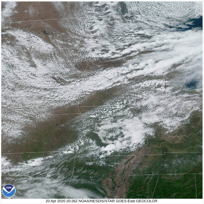
Photo Courtesy of NOAA.

Photo Courtesy of NOAA.

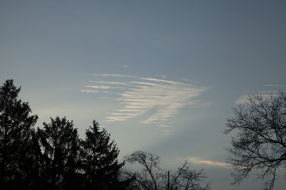
Altocumulus

Altocumulus

Altocumulus

Altocumulus

Altocumulus

Altocumulus

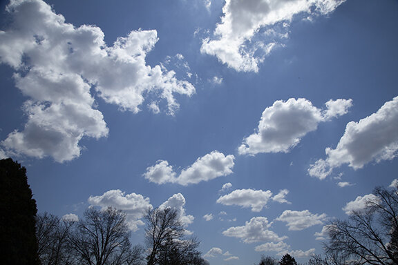
Cumulus

Cumulus

Cumulus

Cumulus

Cumulus

Cumulus

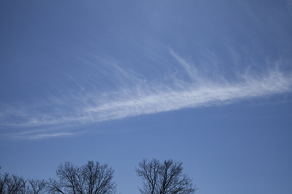
cumulus, large cumulus and streaks of ice crystals (cumulus congestus precipitating ice crystals is located off the upper left of the photo

cumulus, large cumulus and streaks of ice crystals (cumulus congestus precipitating ice crystals is located off the upper left of the photo

Streak of ice crystals falling from large cumulus (cumulus congestus- producing streak not visible)

Streak of ice crystals falling from large cumulus (cumulus congestus- producing streak not visible)

Cumulus and cumulus congestus (Ice crystal streak is falling from cumulus congestus off the upper right of the photo.

Cumulus and cumulus congestus (Ice crystal streak is falling from cumulus congestus off the upper right of the photo.

Rain Shower

Rain Shower

Sprinkles

Sprinkles

Rain shower (Right)

Rain shower (Right)

Rain shower

Rain shower

Backside of Rain Shower

Backside of Rain Shower

Rain shower (left) Altocumulus (center), Cumulus (lower right)

Rain shower (left) Altocumulus (center), Cumulus (lower right)

Cumulonimbus (right) Cumulus/Altocumulus (right)

Cumulonimbus (right) Cumulus/Altocumulus (right)

Clouds of the Day - April 18, 2020

The day Started Clear.

The day Started Clear.

The First Hints of Change were very small cumulus forming

The First Hints of Change were very small cumulus forming

The Altocumulus thickened

The Altocumulus thickened

Nothing but Blue Sky

Nothing but Blue Sky

Altocumulus developed. These clouds were at about 9,500 feet

Altocumulus developed. These clouds were at about 9,500 feet

A few stray altocumulus near the end of the day - Looking Southwest

A few stray altocumulus near the end of the day - Looking Southwest

AltoCumulus at sunset looking west toward an approaching line of clouds. The air was dry and the upward motion with the clouds was very weak - so there was no rain.

AltoCumulus at sunset looking west toward an approaching line of clouds. The air was dry and the upward motion with the clouds was very weak - so there was no rain.

Altocumulus after sunset

Altocumulus after sunset

Altocumulus and cumulus in line of clouds along a trof of low pressure

Altocumulus and cumulus in line of clouds along a trof of low pressure

Streaks of Altocumulus and Altostratus after sunset

Streaks of Altocumulus and Altostratus after sunset

Clouds of the Day - April 17, 2020

Solar heating warms the Earth’s surface. Sunny days warm the ground more than cloudy days. As air temperatures warm, currents of rising and sinking air develop. These currents create a natural ventilation system as warm air rises and cooler air aloft sinks. The system works because of gravity - denser air sinks while less dense air rises. If moisture in the air is sufficient clouds will form. Otherwise the motions may still be there but we don’t see them. Turbulence in clear air is an example of vertical motions that are invisible but we can feel when flying.

Cumulus clouds reveal how rising currents can create puffy clouds. When lower level air temperatures are cool the warm sunshine warms the air, making it less dense. It rises while denser cooler air aloft falls to the surface. In the photos below, the lower cumulus clouds are formed by this less dense rising air. The higher altocumulus clouds in the photos form when an entire layer of air aloft is rising due to upper level upward forcing. This forcing is much different than what is happening in the lower levels. Changes in wind direction and speed, in both horizontal and vertical directions, cause the up an down motions at higher levels. The vertical motions at higher altitudes are usually much gentler than the motions that form near the surface. Examples of both types of motions are found in the photos from today.

There is much more going on in these photos. I will explain in later posts.

Altocumulus above Cumulus

Altocumulus above Cumulus

Altocumulus - cumulus in the mid-levels

Altocumulus - cumulus in the mid-levels

Altocumulus above cumulus.

Altocumulus above cumulus.

Altocumulus above cumulus

Altocumulus above cumulus

Altocumulus

Altocumulus

Cumulus

Cumulus

Later in the morning and early afternoon the cumulus clouds grew as temperatures warmed.

Cumulus (congestus)

Cumulus (congestus)

Cumulus

Cumulus

During the early afternoon the cumulus clouds expanded and merged into a solid cloud deck.

Cumulus (Mediocris foreground; and congestus in background)

Cumulus (Mediocris foreground; and congestus in background)

Cumulus merge to create overcast conditions

Cumulus merge to create overcast conditions

Cumulus and Stratocumulus

Cumulus and Stratocumulus

Cumulus and Stratocumulus

Cumulus and Stratocumulus

Here is what the cumulus cloud field looked like on National Weather Service radar from Des Moines, Iowa. The sky looked like there was precipitation falling aloft but it was not reaching the ground due to evaporation

Radar image is a screengrab from The Radarscope radar display program.

Radar image is a screengrab from The Radarscope radar display program.

The solar radiation chart shows how cloud cover changed during the day. The profile for today (17th) shows sunrise and a steady climb in radiation as the Sun moved higher in the sky. Clouds were causing variations in the radiation. As clouds moved over the sun radiation decreased. This creates the jagged line in the graph. More extensive cloudiness moved in after lunch with large variations during the afternoon. See the pictures above to see how the clouds varied during the day.

Solar_Radiation_4-17-20.PNG

Clouds of the Day - April 16, 2020

Cirrostratus

Cirrostratus

Altocumulus and Altostratus

Altocumulus and Altostratus

Altocumulus

Altocumulus

Cirrostratus (Upper Right) and Altostratus (Lower Left)

Cirrostratus (Upper Right) and Altostratus (Lower Left)

Altocumulus and Altostratus

Altocumulus and Altostratus

Cirrostratus

Cirrostratus

Never Look Directly at the Sun!

Looking directly at the Sun will cause permanent damage or blindness. This includes looking with the naked eye or viewing directly through telescopes, binoculars, or other devices without proper protection! Do not do it! To learn about safe ways to view the Sun read information from the links below. Follow directions exactly!


Halo (Never look directly at the Sun!)

Halo (Never look directly at the Sun!)

Halo (Never Look directly at the Sun!)

Halo (Never Look directly at the Sun!)

Halo (Never look directly at the Sun!)

Halo (Never look directly at the Sun!)

The solar radiation profile for the 16th is shown below. Under clear skies the profile would be a smooth line that reaches a peak around 13:30 (1:30 p.m.) The jagged pattern is caused by clouds, some thin and others thicker), covering and uncovering the Sun.

Solar_Radiation_4-17-20.PNG

Clouds of the Day - April 15, 2020

Under the Spell of Cumulus

Today dawned clear but it didn’t stay that way. The solar radiation profile from today is on the far right of the meteograph below. Notice how radiation increased without interruption through the morning. Around Noon the first dip occurred in the profile before a brief sharp rise again. This coincided with a brief blockage due to clouds. Then came the sudden drop as cumulus clouds formed and spread across the sky. From then on it is easy to see the variations in cloud cover as solar energy increased and decreased quickly through out the afternoon. Look at the pictures below to see how the sky looked during the early afternoon.

SolarEnergy_4-15-20.PNG
Cumulus Clouds from Below

Cumulus Clouds from Below

Cumulus Dark Cloud Base

Cumulus Dark Cloud Base

Wind blown cumulus

Wind blown cumulus

Cumulus forming in cold air - Temperature 36

Cumulus forming in cold air - Temperature 36

One more view of a ragged sky full of cumulus formed by solar heating of a cold air mass

One more view of a ragged sky full of cumulus formed by solar heating of a cold air mass

Clouds of the Day - April 14, 2020

A seasonably cold polar air mass with gusty northerly winds dominates the weather today. Wet soil, wind, and sunshine this morning has enhanced evaporation. April sunshine is much more effective than the winter sun. It did not take long for warming surface temperatures to support updrafts and clouds. Cumulus was the predominate cloud type today and snow showers developed by late morning and early afternoon. There was no accumulation of snow. The photo below show a variety of cumulus ranging from small to medium size.

Cumulus

Cumulus

Cumulus

Cumulus

Cumulus

Cumulus

Cumulus

Cumulus

Cumulus

Cumulus

Cumulus

Cumulus

Cumulus

Cumulus

Cumulus

Cumulus

Cumulus

Cumulus

Cumulus

Cumulus

Cumulus

Cumulus

Clouds of the Day - April 13, 2020

Today dawned clear but it did not end that way. Strong wind and sunshine lead to the formation of cumulus clouds and snow showers.

On a clear day you can see forever. Polar air mass covering the midwest.

On a clear day you can see forever. Polar air mass covering the midwest.

Small Cumulus (cumulus humilus) with small fractus clouds

Small Cumulus (cumulus humilus) with small fractus clouds

Dissipating Cumulus leaves fractus behind. Dry air mixes into the cloud.

Dissipating Cumulus leaves fractus behind. Dry air mixes into the cloud.

Small cumulus clouds

Small cumulus clouds

cumulus (cumulus mediocris)

cumulus (cumulus mediocris)

cumulus (cumulus mediocris)

cumulus (cumulus mediocris)

cumulus (cumulus mediocris)

cumulus (cumulus mediocris)

Cumulus (cumulus mediocris)

Cumulus (cumulus mediocris)

Cumulus (cumulus mediocris)

Cumulus (cumulus mediocris)

SNow showers developed by mid-afternoon. Notice the faint streaks near the center of the photo

SNow showers developed by mid-afternoon. Notice the faint streaks near the center of the photo

The streaks of snow are much more prominant.

The streaks of snow are much more prominant.

The air temperature was in the mid-30s. The source region for the air mass was in northern canada where temperatures were still -10 F.to - 20 F.

The air temperature was in the mid-30s. The source region for the air mass was in northern canada where temperatures were still -10 F.to - 20 F.