Clouds of the Day - Turning a Cloud Red - Saturday, September 23, 2023
/Photo copyright by Craig Johnson, Weather Briefing LC, September 2023
Photo copyright by Craig Johnson, Weather Briefing LC, September 2023
To purchase our 24” x 36” full color cloud chart, go to our online store. It is suitable for framing in a standard 24” x 36” frame.

Learn how to identify clouds by following the Clouds of the Day posts below.

Photo copyright by Craig Johnson, Weather Briefing LC, September 2023

Photo copyright by Craig Johnson, Weather Briefing LC, September 2023

Cumulus congestus, Photo copyright by Craig Johnson, Weather Briefing LC, September 2023

Altocumulus, Photo copyright by Craig Johnson, Weather Briefing LC, September 2023

Altocumulus and Cumulus, Photo copyright by Craig Johnson, Weather Briefing LC, September 2023
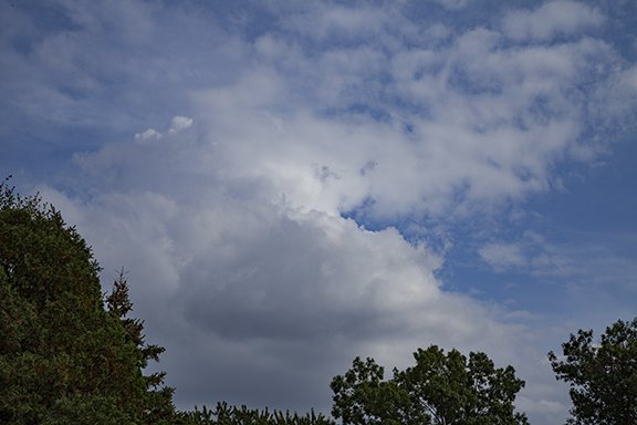
Cumulus congestus, Photo copyright by Craig Johnson, Weather Briefing LC, September 2023

Altostratus, Photo copyright by Craig Johnson, Weather Briefing LC, September 2023
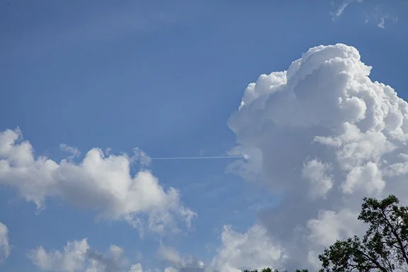
Cumulus congestus and Cumulus, Photo copyright by Craig Johnson, Weather Briefing LC, September 2023
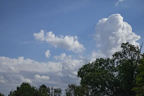
Wider view of Cumulus congestus with altostratus, Photo copyright by Craig Johnson, Weather Briefing LC, September 2023

Cumulus congestus, Photo copyright by Craig Johnson, Weather Briefing LC, September 2023

Cumulonimbus, Photo copyright by Craig Johnson, Weather Briefing LC, September 2023
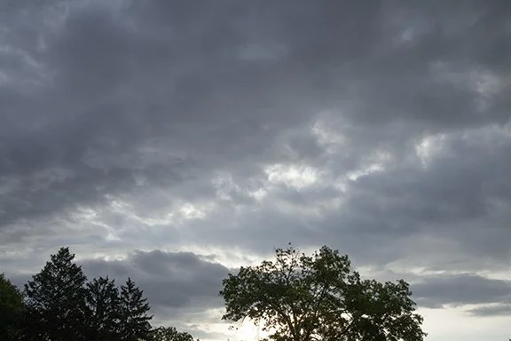
Altocumulus, Photo copyright by Craig Johnson, Weather Briefing LC, September 2023

Altostratus, Photo copyright by Craig Johnson, Weather Briefing LC, September 2023
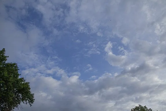
Altocumulus, Photo copyright by Craig Johnson, Weather Briefing LC, September 2023
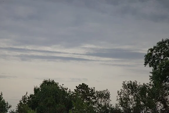
Altostratus, Photo copyright by Craig Johnson, Weather Briefing LC, September 2023
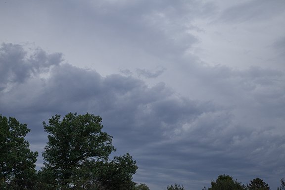
Altostratus (Top) Stratocumulus (Bottom), Photo copyright by Craig Johnson, Weather Briefing LC, September 2023

Altostratus (Top) Stratocumulus (Lower Bottom), Photo copyright by Craig Johnson, Weather Briefing LC, September 2023

Altostratus (Top) Stratocumulus (Bottom), Photo copyright by Craig Johnson, Weather Briefing LC, September 2023

Altostratus (Top) Stratocumulus (Bottom), Photo copyright by Craig Johnson, Weather Briefing LC, September 2023

Cirrus, Photo copyright by Craig Johnson, Weather Briefing LC, September 2023

Cirrus with fall streaks (Virga), Photo copyright by Craig Johnson, Weather Briefing LC, September 2023

Cirrus with Virga (Fall Streaks), Photo copyright by Craig Johnson, Weather Briefing LC, September 2023

, Photo copyright by Craig Johnson, Weather Briefing LC, September 2023

Photo copyright by Craig Johnson, Weather Briefing LC, September 2023

Photo copyright by Craig Johnson, Weather Briefing LC, September 2023

Photo copyright by Craig Johnson, Weather Briefing LC, September 2023

Photo copyright by Craig Johnson, Weather Briefing LC, September 2023

Photo copyright by Craig Johnson, Weather Briefing LC, September 2023

Photo copyright by Craig Johnson, Weather Briefing LC, September 2023

Photo copyright by Craig Johnson, Weather Briefing LC, September 2023

Photo copyright by Craig Johnson, Weather Briefing LC, September 2023

Photo copyright by Craig Johnson, Weather Briefing LC, September 2023
There are many forms of Altocumulus. This version forms a layer of individual cloud elements that are cellular in shape. They are also flat. The cellular structure sets them apart as Altocumulus even though they have the flat characteristic of stratus.
This is an example of why some clouds are may not be easily identified. While we assign names to clouds based on their height. shape, and texture sometimes clouds have a mixture of these characteristics. The altocumulus in the photo above is one example.
These clouds have the characteristics of cumulus and stratus. They are mostly Altocumulus so that is their primary name. However, in cloud naming there is room to add other descriptive names. To better describe them these clouds are Altocumulus stratiformis.
The primary cloud type is Altocumulus and the secondary type is stratus. They are Altocumulus because they are in the middle level of the atmosphere between 6,500 ft (2000 m) and 20,000 feet (5000 m) above sea level. They are also cellular which is a feature of cumulus. The cloud forms by columns of rising air up through the cloud with sinking air surrounding it. The clouds look flat because the air is weakly rising and a temperature inversion (air is warmer above the cloud) which limits the upward motion. There is likely sinking motion pressing downward to the cloud level. The cloud forms where the rising air cools to its condensation temperature. The top of the cloud is limited by the stable layer of air above which is warmer and drier than the air below. All middle level clouds are given the prefix Alto which means “high.” Altocumulus are higher in the atmosphere than Cumulus which are found in the low levels below 6500 ft (2000 m).

Photo copyright by Craig Johnson, Weather Briefing LC, September 2023

Photo copyright by Craig Johnson, Weather Briefing LC, September 2023


Photo copyright by Craig Johnson, Weather Briefing LC, September 2023

Photo copyright by Craig Johnson, Weather Briefing LC, September 2023
We are headed to fall and the transition to autumn weather. That means cooler weather and a change in what cloud types visit our skies. Instead of Cumulus type clouds we begin to see Stratus cloud types. For the moment we are getting the last looks at the puffy clouds of summer. As the Cumulus wane from view they do not disappear suddenly. During the fall months towering thunderstorms (Cumulonimbus) become shorter with weaker updrafts. The threat of severe weather lessens with each passing week as updrafts weaken. The photos below show how clouds reveal the change.
The two photos below are of the same cloud taken a few minutes apart. The left photo shows a Cumulus congestus in the background. It is taller than the Cumulus cloud in the foreground. The cloud in the background has a hard top with many protuberances suggesting the presence of active updrafts. In the right photo the cloud in the background has a softer top with more ragged softer edges which is a sure sign of weakening updrafts. As the weeks pass we will see fewer cumulus type clouds as air masses become more stable. Soon about all we will see are the leaden clouds of stable winter air masses. Those clouds have weaker but broader rising motion that create horizon to horizon flat layered clouds.

Photo Copyright by Craig Johnson

Photo copyright by Craig Johnson

Nimbostratus
This is the definition of a dreary day - a low gray overcast with a drippy sky. But one person’s dreary day is another’s perfect day. Our precipitation has been below normal this year with the precipitation being 11 inches below normal, which is about 2/3rds of what we normally have for the year.
The cloud type is Nimbostratus, a thick layer cloud in the stratus family. The cloud base may range from a few hundred feet above the ground to about 15,000 feet. Nimbostratus that thick develop in a broad deep layer of rising motion with abundant moisture in the air. When rain persists for hours in a moist atmosphere the cloud base lowers as the relative humidity rises due to the evaporation of raindrops. It does not take long for everything to be thoroughly soaked. Nimbostratus produce steady light to moderate rain without lightning and thunder.
Living in the mid latitudes puts us on the highway of storms. The mid latitudes are where weather systems move from west to east. It is where the polar jet streams reside and the weather is always in flux. It is also where we see many different types of clouds whose shapes change from day to day.
Below are two photos of Altocumulus lenticularis clouds. The first photo is a wide shot and the second is a closer view of the cloud located behind the tree-line.
Lenticularis are lense shaped clouds caused by waves in the air. These waves may be invisible or visible. Clouds make the waves visible.
Over low relief terrain like we have in the Midwest lenticularis are relatively rare - but they do occur often enough to be recognizable. The clouds in the photos were part of a group that was in the sky for about an hour as it moved to the southeast. They were due to gravity waves. Gravity waves occur when a layer of stable air is perturbed and moves up and down until the waves dissipate. The area of gravity waves was moving with the main flow of air to the southeast.

Altocumulus lenticularis

Altocumulus lenticularis
Lenticularis clouds are more common near mountain ranges than over the Midwest. Mountains serve as barriers to air flow. If the air is stable (it resists up and down motion), mountains force the air up and over the barrier much like water flowing over rocks in a stream. A layer of stable air causes air to flow over peaks and then to undulate up and down as it moves away from the mountains. Multiple lenticularis may form rows downwind of the peaks. Waves downwind of a mountain range often stand still. They are called standing waves. The air moves through standing waves making the clouds stationary while the air moves through.
The clouds in the photos above were not standing. Not only was the air moving through the waves the entire area of waves was moving downstream with the wind.

Cumulus with Cirrus in the background

Cumulus with Cirrus in the Background

Cumulus with Cirrus in the Background

Cumulus with Cirrus in the Background
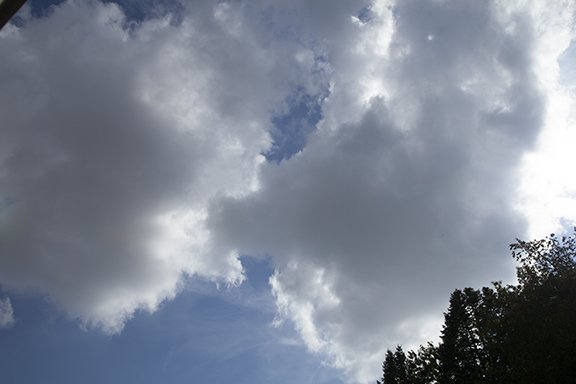
Cumulus with Cirrus in the Background

Cumulus with Cirrus in the Background

Stratocumulus
Stratocumulus is a low cloud type that has both stratus and cumulus characteristics. It is stratus because the cloud is a layer formation. Any vertical development is less that the horizontal extent of the layer. It is cumulus because of the rolls and puffy nature of individual portions within the layer. Rather than picking one over the other the name stratocumulus fits its shape and extent the best.
While this example is in a patch, stratocumulus often cover much of the sky when colder air spreads across the area. This often happens when a large storm system is exiting the area. The cool air in the lower levels is unstable and moisture from the passing storm has moistened the ground and the lower layers of the atmosphere. The stratocumulus layer forms under the base of a stable layer of air aloft which limits the top of the cloud layer. The air is weakly unstable up to the cloud layer which supports the formation of the clouds.
This post is under construction.
High Cumulus are cumulus that form in the middle layers of the Troposphere. You might wonder how cumulus in the middle layer of the atmosphere can be called high cumulus. It’s because middle level cumulus are higher than cumulus in the lower layer. Low level cumulus are just called cumulus.

Altocumulus floccus (tufts of wool)
The Troposphere is the layer of air in the lowest 6 to 10 miles of the Earth’s atmosphere. There are three general cloud families in the Troposphere; low, middle and high.
Next, there are three basic cloud types - stratus, cumulus and cirrus. Stratus are layered clouds, cumulus are puffy or heaped clouds, and cirrus are high hair-like or wispy clouds. Stratus and cumulus clouds are found in all three layers but their names are changed depending on the layer. Cirrus are located the highest layer where temperatures are colder. Cirrus contain mainly ice crystals.

Altocumulus floccus (tufts of wool)
Cumulus in the lowers layer below 6,500 feet (2000 meters) are called, Cumulus. Cumulus in the next highest layer (the middle layer) are called Altocumulus (high cumulus). In Latin Alto means high so middle level cumulus are called Altocumulus - high cumulus.
The highest cumulus clouds are found above the middle layer. They are given the prefix ‘cirrus’ as are all clouds in that layer. Therefore cumulus in the highest layer are called cirrocumulus.

Altocumulus castellanus (castle turrets)
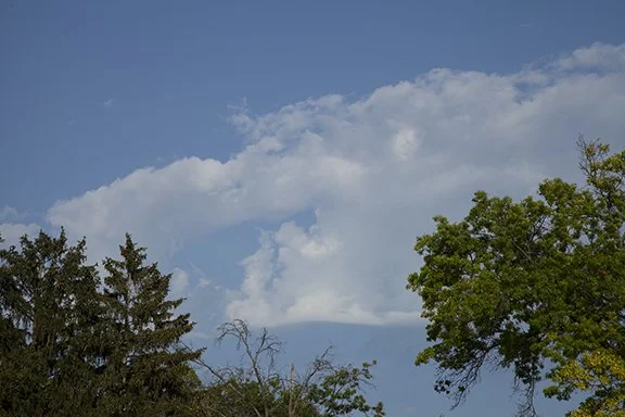
Altocumulus Cumulonimbus congenitus (a failed attempt to form a cumulonimbus)
This post is featuring middle level clouds. All the clouds in the sky today were middle clouds. The most unusual was the cumulonimbus congenitus. It has the look of a miniature cumulonimbus - or thunderstorm but that is all it has. It is not capable of of producing precipitation or lightning and thunder. It just has that look. What it does demonstrate is that weather systems of many sizes share similar characteristics. From the biggest systems to the smallest the circulations that cause them are similar, if not exactly the same except for the size. A cumulonimbus congenitus is just too small to be a real thunderstorm. They are very high based and only light precipitation might reach the ground. On this day, nothing reached the ground. It is an Altocumulus type cloud because it is in the middle levels.
The rising Sun illuminated the bottom of these Altocumulus floccus clouds. The clouds are ragged, like tufts of wool - hence, their name. Because of their cellular structure with vertical developoment these clouds are in the Cumulus family. They are in the mid-level of the atmosphere sphere above 6,500 ft (2000 m) so they are high Cumulus - Cumulus that form between 6,500 and 20,000 feet. Cumulus that form below 6,500 feet are called Cumulus. Cumulus that form above 20,000 feet are called cirrocumulus.


The GOES Visible Satellite Image late this afternoon is showing broad areas of smoke aloft over the Northern Plains. Very thin smoke is also aloft over the eastern Dakotas, Minnesota, Iowa toward the Upper Great Lakes. There is a large area of Cumulus clouds from Minnesota, Wisconsin, to Iowa and Illinois. The Cumulus in eastern Iowa show up on the Solar Radiation measurements on the Weather Briefing weather station.

Compare the graph of the solar energy from yesterday through today on the chart below. Yesterday the sky was clear all day. The trace is symmetrical and smooth indicating a clear sky. The dip in the radiation late in the day is due to an obstruction that temporarily reduced the radiation hitting the solar panel. Contrast that with today. Today it was clear in the morning - again a smooth uniform trace with the solar intensity expected this time of year. This afternoon notice how the amount of energy varies greatly over short periods of only 10 minutes. This shows how variations in solar energy can be dramatic as weather conditions change.

Clouds up high and clouds down low, these clouds have different shapes and textures. The photos show water in 2 of 3 of its phases; vapor, liquid, and ice.
First, the air in all three photos contains water vapor, which is the invisible form of water. Water vapor occurs when ice sublimates, which is ice passing directly from the solid state to an invisible gas (water vapor) without first becoming a liquid, or by liquid water evaporating or boiling.

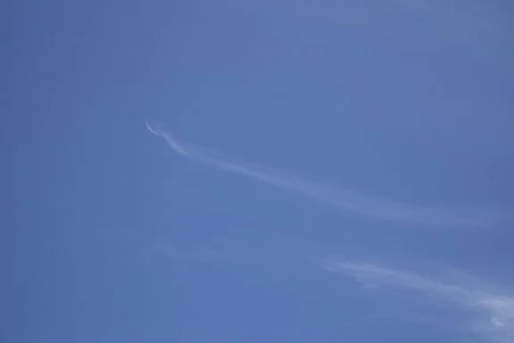
The top two photos are wispy, hairlike clouds (Cirrus and Cirrus uncinus) which are made primarily of ice crystals. While Cirrus are mostly ice crystal clouds, water can exist as a liquid in the atmosphere down to -40 degrees F. Clouds between 32 degrees and -40 degrees may have a mixture of water and ice, depending on other conditions at the cloud level. Cirrus have soft edges because the ice is sublimating, which takes more time than evaporation. Sublimation leaves a softer edge to the cloud.

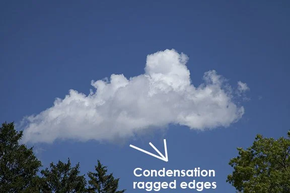
The third photo shows a disintegrating Cumulus cloud which is liquid water (cloud droplets) evaporating. This cloud is warmer than the freezing point of water so it is made of liquid water droplets.
Low clouds in the atmosphere (surface to 6,500 ft) may be all water droplets or a mixture of water and ice. Only in very low temperatures with readings down to -40 degrees F, or colder, would clouds usually be entirely ice.
Mid-level clouds, 6,500 ft. to 20,000 ft. above mean sea level, will be entirely water vapor at temperatures above freezing, or they are a mixture of water and ice at temperatures below freezing.
Most Cirrus-type clouds are entirely ice but Cirrocumulus usually have a mixture of water and ice.

The ragged edges along the bottom of this Cumulus cloud are forming in the updrafts of moist air rising into the cloud. The edge is ragged because the concentration of water vapor varies slightly below the cloud condensation level at the cloud base. It creates ribbons of cloud in the updraft.

This cloud is much higher than the cloud to the left. It is an Altostratus cloud because it is in a layer that is much wider than it is tall. There are elements of Cumulus-type clouds impressed within the layer where vertical motion is sufficient enough to create lumpy clouds in the layer but over-all this is an Altostratus cloud.
The clouds below are Altocumulus. The cloud elements are grouped in a large patch made up of individual Cumulus type clouds. Because they are above 6,500 ft and below 20,000 they are Altocumulus - which is high cumulus. They are much higher than the singular Cumulus cloud in the photo above.

Altocumulus with Cirrus above.

This small patch of Altocumulus is just beginning to form.
Copyright 2016-2024, Weather Briefing, L.C.
Cedar Falls, IA 50613, Phone: 319-215-2634, Email: craig@weatherbriefing.com